Why was the satellite NICT frozen from the day April 2, 2012?
The start of a emission of particles wind from "G" on the opposite side of the magnetopause, perhaps this may be the cause of the disturbance of the TEC and the diagram F2 in the opinion of the experts.
Foulbrood is clear is that we keep the patterns and seismic ionospheric since some weeks ago, in particular from the day April 2 of 2012, the date on which it was reported the storm waves of "G" from the "other side", pattern that has been repeating itself since with date of 9 to 14 March will be detected for the first time, this type of electromagnetic pulse, as it is exposed here.If you want to display the simulation in Batsrus will replace your card here:
Until now, the parameter of the pulses "G" was seen as something external and different from the interaction of the flow of particles from solar storms and their impact in the magnetosphere and the ionosphere, but to date of today, we know that the true cause of the ionospheric and modifications of the magnetosphere, could be related to these pulses.
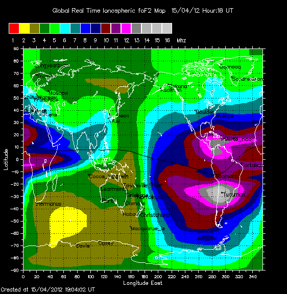
Logic tells us that if there has been no increase in solar activity in the previous days, it makes no sense for lla magnetosphere and the ionosphere submit diagrams of loads such as the following:
As you will see, it makes no sense that the diagram loads in Ionosphere present values higher than the 16MHz, in view of the low solar activity reported during the past few days.
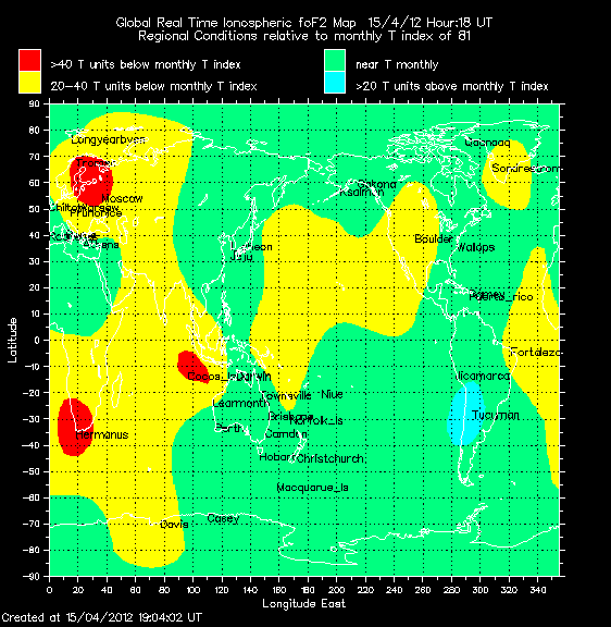
In addition, the accumulated load diagram of the ionosphere F2-TECU on monthly average:
In the diagram shows a fairly high ionospheric load equal to the average across the globe and higher than the monthly average on 20 units in the areas of Latin America, Chile and Argentina.
Remember that the earthquake that struck Indonesia last Wednesday, in particular the same area that years before been devastated by the Tsunami
An earthquake of 8.7 on the Richter scale shook the region north of the island of Sumatra, in Indonesia, whose authorities have given the tsunami warning.
The Center of Tsunami Warning of the Pacific it was reported that the warning of the risk affects 28 countries bordering on the Indian Ocean and accurate that the first waves could reach the coast of Sumatra toward 09:30 GMT.
The seismological institute of Indonesia cut the power to 8.5 degrees, while the geological service of the United States left in 8.7 .
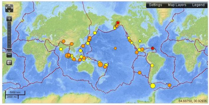
Remember that the report from the USGS real-time is the following:
Then the detail of the 7174 is seismic movements of the past 30 days.
The probable areas of risk for the proimas 48 hours, are:
The West Coast of Northern Sumatra
StarViewerTeam International 2012.


Comments
Just as what my Scientist friend tried to explain in one of my posts today, there are allot of things happening now than we are told about, or will be told about.
I don't know either, but an envisat satellite went dark: http://www.space.com/15369-mysteriously-silent-envisat-satellite-sp...
Thanks for posting Amy.