All Posts (170)

Sort by

5.3 & 5.4 Magnitude Earthquakes in West Chile Rise

Earth Watch Report - Earthquakes


....

5.3

West Chile Rise

2012-11-17 18:43:52

37.020°S

94.967°W

10.8


....

M5.3 - West Chile Rise 2012-11-17 18:43:52 UTC


Earthquake location 37.020°S, 94.967°W

Event Time

  1. 2012-11-17 18:43:52 UTC
  2. 2012-11-17 12:43:52 UTC-06:00 at epicenter
  3. 2012-11-17 12:43:52 UTC-06:00 system time

Location


37.020°S 94.967°W depth=10.8km (6.7mi)

Nearby Cities

  1. 1512km (940mi) WSW of San Juan Bautista, Chile
  2. 1886km (1172mi) W of Lebu, Chile
  3. 1892km (1176mi) W of Ancud, Chile
  4. 1907km (1185mi) W of Canete, Chile
  5. 2242km (1393mi) WSW of Santiago, Chile


....

5.4

West Chile Rise

 2012-11-17 18:12:21

37.160°S

94.968°W

10.1


....

M5.4 - West Chile Rise 2012-11-17 18:12:21 UTC


Earthquake location 37.160°S, 94.968°W

Event Time

  1. 2012-11-17 18:12:21 UTC
  2. 2012-11-17 12:12:21 UTC-06:00 at epicenter
  3. 2012-11-17 12:12:21 UTC-06:00 system time

Location


37.160°S 94.968°W depth=10.1km (6.3mi)

Nearby Cities

  1. 1515km (941mi) WSW of San Juan Bautista, Chile
  2. 1884km (1171mi) W of Lebu, Chile
  3. 1886km (1172mi) W of Ancud, Chile
  4. 1902km (1182mi) W of Castro, Chile
  5. 2243km (1394mi) WSW of Santiago, Chile
Read more…

Earth Watch Report - Volcanic Events

Chirpoi volcano (Kurile Islands, Russia) activity update: steaming, hot spot detected on satellite images

 
BY: T


Volcano Discovery

Steam plume from Chirpoi volcano on 16 Nov (NASA)
Hot spot at Chirpoi (summarized 10-17 Nov data, MODIS / Univ. Hawaii)


A hot spot is visible on recent MODIS satellite images at the volcano and a dense steam plume drifting SE can be seen on a Aqua satellite image from 16 Nov 2012. Although KVERT lists the volcano as green, it is likely that some activity is occurring at the volcano.

The Kuril Islands form part of the ring of tectonic instability encircling the Pacific ocean referred to as the Ring of Fire. The islands themselves are summits of strato-volcanoes that are a direct result of the subduction of the Pacific Plate under the Okhotsk Plate, which forms the Kuril Trench some 200 kilometers (120 mi) east of the islands. The chain has around 100 volcanoes, some 40 of which are active, and many hot springs and fumaroles. There is frequent seismic activity, including a magnitude 8.5 earthquake in 1963 and one of magnitude 8.3 recorded on November 15, 2006, which resulted in tsunami waves up to 5 feet (1.5 m) reaching the California coast.


Read more…


Earth Watch Report

East Coast faces variety of tsunami threats

The most likely source for an East Coast tsunami would be an underwater avalanche along the continental slope.

By Douglas Main, OurAmazingPlanet Staff Writer
tsunami evacuation route sign
An offshore earthquake of magnitude 4.5 or above could cause submarine avalanches and create dangerous tsunamis with waves higher than 26 feet. (Photo: epugachev/flickr)
An offshore earthquake of magnitude 4.5 or above could cause submarine avalanches and create dangerous tsunamis with waves higher than 26 feet.

The most likely source for an East Coast tsunami would be an underwater avalanche along the continental slope.

Although the risk is small, tsunamis are possible on the East Coast of the United States from a variety of sources, according to new research.

And as Hurricane Sandy showed, the region is completely unprepared for a major influx of water, said U.S. Geological Survey researcher Uri ten Brink.

The most likely source for an East Coast tsunami would be an underwater avalanche along the continental slope, according to research presented by ten Brink and others earlier this month at the annual meeting of the Geological Society of America in Charlotte, N.C. Ten Brink also outlined several other possible sources of tsunamis, including earthquakes and even collapsing volcanoes.

Underwater avalanches

An offshore earthquake of magnitude 4.5 or above could cause submarine avalanches and create dangerous tsunamis with waves higher than 26 feet (8 meters), ten Brink told OurAmazingPlanet. Underwater canyons and bays could focus these waves and make them even bigger.

A 7.2-magnitude earthquake off the southern coast of Newfoundland in 1929 caused a large underwater landslide, creating a large wave that rushed ashore and killed 28 people on the island, ten Brink said. The waves were up to 26 feet high until some reached narrow inlets, where they grew to 43 feet (13 m), he said.

While the tsunami was catastrophic for Newfoundland, it created only small waves for most of the U.S. coast and didn’t cause any fatalities there. That’s typical of tsunamis from submarine landslides: They tend to be large for nearby areas but quickly taper off, ten Brink said.

While this is the only example of a tsunami near the East Coast in recorded history, there are plenty of areas along the continental slope – where the North American continent ends and drops into the Atlantic Ocean basin – at risk for these landslides, ten Brink said.

Ten Brink and his colleagues are currently taking core samples of sediment from the submarine canyons along the continental slope, to find evidence of past landslides and how often landslides occur, he said. His team has been working for more than five years to map these submarine canyons with sonar to highlight areas most at risk of landslides, he added.

The Puerto Rico trench

The movement of tectonic plates beneath the ocean can create waves that travel much farther than those caused by submarine landslides, because they involve the movement of a much larger volume of water, with longer waves that don’t quickly dissipate, ten Brink said. The most dangerous earthquakes are those at subduction zones, where one plate dives beneath another.

While the most infamous subduction zones are found around the Pacific Ring of Fire – such as the one that set off the massive 2011 Japan tsunami – there is indeed a subduction zone capable of creating tsunamis near the East Coast. In the northeast Caribbean, the area called the Puerto Rico trench features a subduction zone.

When the 2004 Indian Ocean tsunami hit, ten Brinks’ group received funding from the U.S. government to study the tsunami potential of the Puerto Rico trench. Although its work is still ongoing, his group has found that much of the fault doesn’t appear capable of creating an earthquake and tsunami large enough to cause big problems for the East Coast. But a tsunami originating there could cause significant destruction in the Caribbean.

University of Puerto Rico researcher Zamara Fuentes, who isn’t involved in ten Brinks’ research, said one quake in this region in 1918 created a tsunami that killed 116 people on Puerto Rico. Fuentes studies sediment cores around the Caribbean to look for evidence of past tsunamis. Based on historical records, the USGS says 27 tsunamis in the Caribbean have caused fatalities and extensive damage since the 16th century.

Risks across the Atlantic

Another possible source for East Coast tsunamis is the Azores-Gibraltar Transform Fault, off the coast of Portugal. One massive earthquake along this fault in 1755 destroyed most of Lisbon and created a tsunami recorded as far away as Brazil. It was barely noticed on the East Coast, however, ten Brink said. His group has created computer models that suggest underwater mountains west of Portugal helped reduce the impact of this tsunami by slowing the waves and disrupting their movement – and they could do the same thing in the future.

The nearby Canary Islands, off the coast of Morocco, also present a possible hazard. One large volcano on the island of La Palma, called Cumbre Vieja, could erupt, collapse and create a large tsunami capable of reaching the East Coast. A 2001 study suggested this series of events could send a 70-foot (21 m) wave crashing into the East Coast. But ten Brink said that study hasn’t held up to subsequent review, and that the wave would be unlikely to exceed several feet in height by the time it reached North America. “I don’t see it as a credible threat,” he said.

The last possible tsunami source is a slow-moving fault north of Cuba, which has caused earthquakes in the past and possibly could create a tsunami that affected Florida and the Gulf Coast. Due to the current political situation, neither Cuban nor American researchers can conduct research in the area, he said.

To get a good idea of how often tsunamis from this or any source are likely to strike the East Coast in the future, ten Brink and others are trying to peer back in time – but much remains to be discovered. “There are more questions than answers at this point,” ten Brink said.

Read more…

Earth Watch Report


Red rain in Sri Lanka

Ridma Dissanayake

Rare showers of red rain fell for over 15 minutes in Sewanagala, Monaragala and Manampitiya,Polonnaruwa yesterday morning hours of yesterday and day before yesterday. According to Meteorology Department sources red rain fell heavily in these areas and the reason has not been found yet.

Red rain in Sewanagala and Manampitiya left red frost on the ground. This is the first time red rain was witnessed in Sri Lanka. The Health Ministry Secretary informed Medical Research Institute (MRI) Director Dr Anil Samaranayake to conduct a study to ascertain the reasons for red rain by taking water samples from Monaragala and Polonnaruwa.

Increase in the acidity of the air and sand storms are the usual reasons for red rain. However, there are no sand storms in Sri Lanka. India had red rain last year and Indian scientists discovered a variety of micro organisms as a reason for the rains. Since the micro organisms had no DNA, they guessed it had to be a strange phenomenon.

The MRI is carrying out research to find the exact reason for red rain in Sri Lanka.

Read more…

Earth approaching objects

Earth Watch Report - Space


....

Earth approaching objects (objects that are known in the next 30 days)

Object Name Apporach Date Left AU Distance LD Distance Estimated Diameter* Relative Velocity
(1999 SF10) 18th November 2012 2 day(s) 0.0346 13.5 41 m - 92 m 4.08 km/s 14688 km/h
(2009 WB105) 23rd November 2012 7 day(s) 0.0400 15.6 59 m - 130 m 18.86 km/s 67896 km/h
(2007 VB188) 24th November 2012 8 day(s) 0.1446 56.3 14 m - 32 m 10.32 km/s 37152 km/h
(1994 XD) 26th November 2012 10 day(s) 0.0518 20.2 400 m - 890 m 20.03 km/s 72108 km/h
(2009 LS) 27th November 2012 11 day(s) 0.1418 55.2 670 m - 1.5 km 25.88 km/s 93168 km/h
(2010 VW98) 28th November 2012 12 day(s) 0.1321 51.4 81 m - 180 m 7.03 km/s 25308 km/h
(2009 XH8) 29th November 2012 13 day(s) 0.1288 50.1 61 m - 140 m 6.70 km/s 24120 km/h
(2008 WJ60) 07th December 2012 21 day(s) 0.1631 63.5 160 m - 350 m 9.11 km/s 32796 km/h
(2007 WM3) 07th December 2012 21 day(s) 0.1561 60.8 64 m - 140 m 9.47 km/s 34092 km/h
(2008 YZ28) 08th December 2012 22 day(s) 0.1637 63.7 270 m - 590 m 21.11 km/s 75996 km/h


....


Read more…

Earth Watch Report


....

17.11.2012 Extreme Weather Portugal Distrito Faro, [Silves e Lagoa area] Damage level
 
Details


....

Extreme Weather in Portugal on Friday, 16 November, 2012 at 17:37 (05:37 PM) UTC.

Description
The National Authority for Civil Protection (ANPC) confirm the occurrence of two phenomena very strong winds, but can not yet characterize these phenomena, which have caused dozens of wounded, some of them severe. The ANPC explained to CM Journal that between 13h00 and 13h30 on Friday strong winds ravaged Silves and Lagoa causing dozens of wounded, some in critical condition. The damages are huge in dozens of vehicles, registering falling trees, shingles flew, fallen walls and damages inside homes. The wind afected a campers field in Silves, near the municipal swimming pools. Some of the caravans had affected people inside who were injured. The coverage of countertops Football Stadium of Silves flew with the wind strength. In Lagoa in several buildings housing the wind broke the windows and destroyed the interior of the houses. Through the streets sees overturned cars, fallen trees, roofs raised, in a scene of destruction. Authorities are still on the ground, to take stock of possible destruction, and therefore not yet possible to come up with a concrete number of injured and the severity of these injuries.


....

Extreme Weather in Portugal on Friday, 16 November, 2012 at 17:37 (05:37 PM) UTC.


Back

Updated: Saturday, 17 November, 2012 at 04:49 UTC
Description
Trees were uprooted, balconies, roof tiles and framework ripped off, windows shattered and vehicles tossed for metres. Many local residents were affected by the freak incident in which the entire neighbourhood was reduced to tatters and people were seriously injured. Panicking parents rushed to a nearby-by school to collect their children who were in class when the tornado hit, and billboards on a nearby roundabout were mangled. The exact extent of the damage and seriousness of the injuries is still being calculated but initial assessments suggest thirteen people were injured, three of whom seriously. The State Secretary for Welfare and Social Security has confirmed that four families, a total of eleven people, six of whom minors, need to be rehomed. Abel Silva, born and raised in Lagoa, saw his ground-floor apartment destroyed in the terrifying incident which last merely minutes.

"It was overwhelming. All of a sudden my windows started shaking, the ground was trembling. I tried to hold the windows but I saw they were going to blow I so I threw myself to the side. The entire house has been destroyed. I've never seen anything like this before." People in a nearby cafe said: "The sky turned pitch black, the wind became so dense you could see it, and it seemed like everything was shaking. The windows were rattling. A metal sheet from a nearby building site was ripped up. We were told to get back and stand away from the windows. The power went out. It was like something from a movie." GNR police confirmed that there were serious injuries and many families have been left temporarily homeless. Emergency services were drafted in from neighbouring districts to try to bring the pandemonium under control. The National Civil Protection Authority (ANPC) dispatched emergency services to Lagoa and Silves from as far away as Beja, Setatildebal and Avora. Bad weather including strong winds, thunder and lightening tormented the Algarve today on Friday. There was a power shortage in Lagos caused by persistent stormy weather, the village of Ferragudo and city of Albufeira flooded, and damage was caused to several locations across the region.

Residents in Silves told The Portugal News "it looks like a bomb has hit it." Eyewitness reports said a glass dome that once sat on top of the Town Hall shattered. In Alvor a roof was ripped off a school and a cafe-kiosk in the heart of the village was completely removed from its spot. Around 226 men and women and 68 vehicles were sent to the cities. Information from the ANPC website confirms 13 people were injured as a result of the tornado and no deaths were caused. An emergency rescue helicopter was also dispatched at 2.55pm but later retracted. The Weather Institute (IM) placed the Algarve under orange alert - a warning of moderate to high risk meteorological situation. Heavy downpours accompanied by strong winds and thunder were predicted, but thankfully proved unfounded.


....

Read more…

Biological Hazard in USA – Legionnaires disease

Earth Watch Report


.....

Today Biological Hazard USA State of Pennsylvania, Pittsburgh [VA Pittsburgh Healthcare Systems University Drive Campus] Damage level Details


.....

Biological Hazard in USA on Saturday, 17 November, 2012 at 10:55 (10:55 AM) UTC.

Description
Four patients at VA Pittsburgh Healthcare System’s University Drive Campus in Oakland this week developed pneumonia caused by Legionnaires’ disease, and more might have been exposed to the potentially deadly bacteria, officials said on Friday. The source of the infection was traced to the hospital’s water distribution system, prompting workers to change the way the system is disinfected. The four Legionnaires’ patients, whose identities cannot be released by hospital officials according to federal law, were successfully treated with “good outcomes” and have been released from the hospital, said Dave Cowgill, spokesman for VA Pittsburgh Healthcare System. Cowgill wrote in an email that the restrictions on water use started Friday and would remain in effect until administrators are sure the bacteria is gone. Workers distributed bottled water to be used by patients and visitors. An internal memo to medical staff from infection control chief Robert Muder obtained by the Tribune-Review asked physicians to monitor other patients for hospital-acquired Legionnaires’ infections because the incubation period can be as long as 14 days.In the memo, Muder asked doctors to treat any other patients determined to be affected with a “timely administration of antibiotics” and to report all new diagnoses of pneumonia to the infectious disease department within 30 days. He could not be reached for comment. The hospital conducted an investigation with the help of the Centers for Disease Control and Prevention and found an elevated concentration of the bacteria called Legionella, which tends to survive in the moist air-conditioning systems of large buildings and within waterlines and storage systems that get irregular or little use. Water fountains inside the hospital on Friday were covered with signs: “Due to a water line problem, this fountain is out of service.” Employees said they were told not to drink the water or use the ice machine. Most people exposed to the Legionella bacteria do not become ill. Elderly people, smokers and individuals with chronic lung disease or weakened immune systems are more vulnerable.
Biohazard name: Legionnaires disease
Biohazard level: 4/4 Hazardous
Biohazard desc.: Viruses and bacteria that cause severe to fatal disease in humans, and for which vaccines or other treatments are not available, such as Bolivian and Argentine hemorrhagic fevers, H5N1(bird flu), Dengue hemorrhagic fever, Marburg virus, Ebola virus, hantaviruses, Lassa fever, Crimean-Congo hemorrhagic fever, and other hemorrhagic or unidentified diseases. When dealing with biological hazards at this level the use of a Hazmat suit and a self-contained oxygen supply is mandatory. The entrance and exit of a Level Four biolab will contain multiple showers, a vacuum room, an ultraviolet light room, autonomous detection system, and other safety precautions designed to destroy all traces of the biohazard. Multiple airlocks are employed and are electronically secured to prevent both doors opening at the same time. All air and water service going to and coming from a Biosafety Level 4 (P4) lab will undergo similar decontamination procedures to eliminate the possibility of an accidental release.
Symptoms:
Status: confirmed


....

Read more…

Epidemic Hazard in Uganda Ebola

Earth Watch Report


...

16.11.2012 Epidemic Hazard Uganda Central Uganda, [Sombwe Parish, Nyimbwa Sub County, Luwero district] Damage level Details


.....

Epidemic Hazard in Uganda on Wednesday, 14 November, 2012 at 15:10 (03:10 PM) UTC.

Description
The deadly Ebola hemorrhagic fever has broken out in the central Ugandan district of Luwero about one month after the World Health Organization (WHO) declared the East African country free of the disease. Joaquim Saweka, the WHO country representative told Xinhua by telephone on Wednesday that the outbreak was confirmed on Tuesday following laboratory tests that turned out positive for the disease. “Yes that is true, we have dispatched one team to make preliminary assessment and also set up an isolation unit,” he said. The epicenter of the outbreak is in Sombwe Parish, Nyimbwa Sub County, Luwero district which is located about 40km north of the capital Kampala. Joseph Okware, the Luwero District Health Officer was quoted by Daily Monitor on Wednesday as saying that two people belonging to the same family had died of the disease over the weekend. The outbreak comes at a time when the country is still experiencing the deadly Marburg fever in several parts of western Uganda. In July this year the Ebola outbreak in the Midwestern Ugandan district of Kibaale left at least 20 people dead. Ebola victims present with symptoms like fever, vomiting, diarrhea, abdominal pain, headache, measles-like rash, red eyes, and sometimes with bleeding from body openings.
Biohazard name: Ebola
Biohazard level: 4/4 Hazardous
Biohazard desc.: Viruses and bacteria that cause severe to fatal disease in humans, and for which vaccines or other treatments are not available, such as Bolivian and Argentine hemorrhagic fevers, H5N1(bird flu), Dengue hemorrhagic fever, Marburg virus, Ebola virus, hantaviruses, Lassa fever, Crimean-Congo hemorrhagic fever, and other hemorrhagic or unidentified diseases. When dealing with biological hazards at this level the use of a Hazmat suit and a self-contained oxygen supply is mandatory. The entrance and exit of a Level Four biolab will contain multiple showers, a vacuum room, an ultraviolet light room, autonomous detection system, and other safety precautions designed to destroy all traces of the biohazard. Multiple airlocks are employed and are electronically secured to prevent both doors opening at the same time. All air and water service going to and coming from a Biosafety Level 4 (P4) lab will undergo similar decontamination procedures to eliminate the possibility of an accidental release.
Symptoms:
Status: confirmed


......

Epidemic Hazard in Uganda on Wednesday, 14 November, 2012 at 15:10 (03:10 PM) UTC.


Back

Updated: Thursday, 15 November, 2012 at 11:55 UTC
Description
At least three people are confirmed to have died from Ebola haemorrhagic fever since last month, the health ministry has said. All the three victims were members of the same family in Kakute sub-county, Sambu Parish, Nyimbwa sub-county. âA total of three people have since died since the onset of the outbreak in Luweero district,â health minister, Dr Christine Odoa said Thursday while addressing journalists at the media centre. The first case, a boda boda rider died on October 25 after presenting signs of high fever and bleeding from some body parts, although no samples were taken for testing, nor was the case reported to the health centre. The second case, a 25 year old woman died on Saturday after nursing the boda boda cyclist while the third, also a member of the same family, died on Monday at Nyimbwa Health Centre IV. At least five people suspected to have come into contact with those infected or the deceased are under isolation. Two of these admitted at Mulago Hospital, one at Bombo Hospital and three in Luweero. The acting director general of health services, Dr Dennis Lwamafa said health experts were also tracing at least fifteen suspected cases in different parts of the country. The recent Ebola outbreak comes barely two months after the country was declared Ebola-free. The health ministry has dispatched a team of experts to assess the situation in Luweero, and plans are underway to create isolation centres at Nyimbywa Health Centre IV and Bombo Hospital. Dr Miriam Nanyunja, the WHO disease prevention and control advisor said a team of health experts had arrived to boost efforts to contain the epidemic.


.....

Epidemic Hazard in Uganda on Wednesday, 14 November, 2012 at 15:10 (03:10 PM) UTC.


Back

Updated: Friday, 16 November, 2012 at 12:40 UTC
Description
Three more residents of Nyimbwa in Luweero district have tested positive to the Ebola haemorrhagic fever. This brings the number of confirmed Ebola cases in the district since last month to six, three of whom have died. "The blood samples for three people which we sent yesterday have come out indicating they are also infected with Ebola" Richard Kawenyera, the district Ebola surveillance officer, told Saturday Vision yesterday (Friday). Kawenyera did not divulge details about the patients saying he was too busy. But it is believed that they are related to the three members of the same family who died in Kakute sub-county, Sambu Parish, Nyimbwa sub-county. The first case, a boda boda rider died on October 25 after presenting signs of high fever and bleeding from some body parts, although no samples were taken for testing, nor was the case reported to the health centre. The second case, a 25 year old woman died on Saturday after nursing the boda boda cyclist while the third, also a member of the same family, died on Monday at Nyimbwa Health Centre IV. About two other people suspected to have come into contact with those infected or the deceased are under isolation at Mulago Hospital. The acting director general of health services, Dr Dennis Lwamafa said health experts were also tracing at least fifteen suspected cases in different parts of the country. The recent Ebola outbreak comes barely two months after the country was declared Ebola-free. The health ministry has dispatched a team of experts to assess the situation in Luweero, and plans are underway to create isolation centres at Nyimbwa Health Centre IV and Bombo Hospital. Dr Miriam Nanyunja, the WHO disease prevention and control advisor said a team of health experts had arrived to boost efforts to contain the epidemic.


.....

Read more…

Earth Watch Report


16.11.2012 Biological Hazard Australia State of New South Wales, [Near to Maitland, Hunter Valley] Damage level Details


..............

Biological Hazard in Australia on Thursday, 15 November, 2012 at 04:31 (04:31 AM) UTC.

Description
An unidentified strain of bird flu has been detected at a hen farm near Maitland in the Hunter Valley, prompting authorities to quarantine about 50,000 chickens. The suspected virus is not thought to be the deadly H5N1 strain of bird flu that has killed 359 people worldwide in sporadic outbreaks since 2003. Nonetheless, the 50,000 hens may have to be destroyed, the NSW Department of Primary Industries said. A "first response team" of specialists from the department is on site to enforce the quarantine, while the CSIRO runs lab tests on samples of the virus, with results expected this afternoon. "The suspected virus is definitely not the highly pathogenic H5N1 strain that has gained worldwide attention — nor is it closely related to that strain," the NSW chief veterinary officer, Ian Roth, said in a statement. "Australia has previously had a small number of outbreaks of avian influenza viruses, which were all quickly and successfully eradicated," Dr Roth said. "The property has been placed under quarantine and initial tracing and surveillance is being undertaken to confirm that the virus hasn't spread. We currently have no evidence to suggest it has." The department said Australia has had five outbreaks of avian influenza in chickens between 1976 and 1997 – three in Victoria and one each in NSW and Queensland.
Biohazard name: H5N1 (highly pathogenic avian influenza)
Biohazard level: 4/4 Hazardous
Biohazard desc.: Viruses and bacteria that cause severe to fatal disease in humans, and for which vaccines or other treatments are not available, such as Bolivian and Argentine hemorrhagic fevers, H5N1(bird flu), Dengue hemorrhagic fever, Marburg virus, Ebola virus, hantaviruses, Lassa fever, Crimean-Congo hemorrhagic fever, and other hemorrhagic or unidentified diseases. When dealing with biological hazards at this level the use of a Hazmat suit and a self-contained oxygen supply is mandatory. The entrance and exit of a Level Four biolab will contain multiple showers, a vacuum room, an ultraviolet light room, autonomous detection system, and other safety precautions designed to destroy all traces of the biohazard. Multiple airlocks are employed and are electronically secured to prevent both doors opening at the same time. All air and water service going to and coming from a Biosafety Level 4 (P4) lab will undergo similar decontamination procedures to eliminate the possibility of an accidental release.
Symptoms:
Status: suspected


.................

Biological Hazard in Australia on Thursday, 15 November, 2012 at 04:31 (04:31 AM) UTC.


Back

Updated: Friday, 16 November, 2012 at 06:14 UTC
Description
Australia's first outbreak of a highly pathogenic bird flu virus in 15 years should be contained by a cull of 50,000 chickens, authorities said on Friday, although they do not know what caused the case at an egg farm in New South Wales state. The Department of Primary Industries (DPI) said all chickens at the property in Maitland, 160 km (100 miles) north of Sydney, will be destroyed after the H7 virus was detected last week. The H7 strain is highly pathogenic to birds but is not related to the H5N1 strain, which was first detected in 1997 in Hong Kong and has since caused hundreds of human deaths. DPI Chief Veterinary Officer Ian Roth said the strain did not present any risks to food safety from poultry and eggs. The owners of the infected farm have been quarantined as experts try to find the source of the virus, often wild birds. "It generally spreads by the movement of birds from the farm and there certainly hasn't been any of those," Roth told Australian Broadcasting Corporation radio. "We're in the process now of doing the tracing and also surveillance in the area, and so far the tracing looks quite good. There hasn't been much potential for spread," he said. Australia's agriculture ministry reported the outbreak to the Paris-based animal health body OIE on Thursday.
Read more…

Earth Watch Report


....

Today Extreme Weather Australia State of New South Wales, [Lismore, Tenterfield, Inverell, Ballina, Casino and Kyogle] Damage level Details

....

Extreme Weather in Australia on Saturday, 17 November, 2012 at 12:03 (12:03 PM) UTC.

Description
A severe weather warning has been issued for much of northern NSW with 90-kilometres-an-hour winds and marble-sized hailstones recorded on the coast. The Bureau of Meteorology (BoM) issued the warning just after 8pm (AEDT) on Saturday for people living in the Northern Rivers, Northern Tablelands and parts of the North West Slopes and Plains. The bureau warned that "severe thunderstorms" were forecast to produce large hailstones and heavy rainfall, leading to flash flooding and damaging winds in the area over several hours. Locations which may be affected include Lismore, Tenterfield, Inverell, Ballina, Casino and Kyogle. At 8pm, gusts reaching 90km/h were recorded in Woodburn near the Queensland coast with marble-sized hail also lashing the region. The wild weather was predicted to move northeast towards Ballina before moving out to sea later on Saturday night.


....

Today Extreme Weather Australia State of Queensland, [Brisbane, Gold and Sunshine Coasts, Darling Downs and Wide Bay regions] Damage level
 
Details


....

Extreme Weather in Australia on Saturday, 17 November, 2012 at 05:00 (05:00 AM) UTC.

Description
A massive thunderstorm is hitting southeast Queensland, bringing torrential rain, flash flooding and blacking out homes. A weather alert was posted by the Bureau of Meteorology just minutes before rain smacked the east coast, leaving thousands of people without power. Weatherzone reported more than 4000 lightning strikes within 80km of Brisbane in the space of one hour. A police spokesman said 50 people were evacuated from an inner-city building after the storm caused a partial cave-in of the roof of a lodge in the inner suburb of Wilston. He said the storm had also caused a minor fire in Seventeen Mile Rocks, in Brisbane's south-west, after a house was struck by lightning. Police also reported they fallen trees across roads in Milton, Kangaroo Point and the Fortitude Valley area. People in Brisbane, Redlands, North Stradbroke and parts of the Gold Coast. Logan and Moreton Bay have been badly hit with thousands of homes left without power, falshing flooding and partial road closures. An Energex spokeswoman said many homes and businesses had been left without power, particularly on Brisbane's southside. "It's widespread at the moment. We can see there are about 6000 or 7000 homes and businesses around our network without power," she said. Supercell thunderstorms with the potential to create tornadoes are threatening to smash NSW and Queensland this weekend. Considered the most dangerous storms, supercells develop where wind shear is present through a very unstable atmosphere. "Supercell thunderstorms are likely to produce severe weather," said Tom Saunders, Senior Meteorologist at The Weather Channel. He said such extreme weather events were "likely across northeast New South Wales and southeast Queensland this weekend and have the potential to cause flash flooding, damaging winds and large hail". "The wind shear leads to rotation within the storm and a longer lifespan," he said. "Supercells often cause very heavy rain and flash flooding, large hail, damaging winds gusts and occasionally tornadoes.


....

Read more…

Earth Watch Report - Earthquakes

5.3

58km SSE of Hasaki, Japan

2012-11-16 08:25:57

35.231°N

141.046°E

34.6


M5.3 - 58km SSE of Hasaki, Japan 2012-11-16 08:25:57 UTC


Earthquake location 35.231°N, 141.046°E


Event Time

  1. 2012-11-16 08:25:57 UTC
  2. 2012-11-16 17:25:57 UTC+09:00 at epicenter
  3. 2012-11-16 02:25:57 UTC-06:00 system time

Location


35.231°N 141.046°E depth=34.6km (21.5mi)

Nearby Cities

  1. 58km (36mi) SSE of Hasaki, Japan
  2. 60km (37mi) E of Ohara, Japan
  3. 64km (40mi) SSE of Asahi, Japan
  4. 68km (42mi) SE of Yokaichiba, Japan
  5. 132km (82mi) ESE of Tokyo, Japan


.........................................


5.3

Pacific-Antarctic Ridge

2012-11-16 06:24:42

53.996°S

134.682°W

10.1

M5.3 - Pacific-Antarctic Ridge 2012-11-16 06:24:42 UTC


Earthquake location 53.996°S, 134.682°W


Event Time

  1. 2012-11-16 06:24:42 UTC
  2. 2012-11-15 21:24:42 UTC-09:00 at epicenter
  3. 2012-11-16 00:24:42 UTC-06:00 system time

Location


53.996°S 134.682°W depth=10.1km (6.3mi)

Nearby Cities

  1. 2202km (1368mi) NNW of Siple, Mount, Antarctica
  2. 3918km (2435mi) SE of Masterton, New Zealand
  3. 3929km (2441mi) SE of Gisborne, New Zealand
  4. 3932km (2443mi) ESE of Dunedin, New Zealand
  5. 3234km (2010mi) S of Adamstown, Pitcairn
Read more…

Earth Watch Report

Dangerous changes on earth: New huge land cracks. This time in Spain,

Above Top Secret

Remember the 2011 Lorca(Murcia) earthquake from 11 may 2011.
With a magnitude of 5.1 at only a depht of 1 km.
Lots of buildings and historical monuments were damaged, 10 deaths and over 400 people were injured.

Now in that same region the earth is cracking up.

The crack extends along the industrial park in the direction of the sport city “Valverde Reina”; It has a length of more than 300 meters and a depth of more than two metres in some places.

According to europapress.es at the beginning of November, cracks appeared on top of a cliff at Cotillo, located at the northern end of Fuerteventura, one of the Canary Islands, in the Atlantic Ocean off the coast of Africa.


link
If those are the same cracks that are showing on the mainland I would imagine more cracks will appear on that line. The distance between the island and the place where the cracks are reported in Murcia is over 2000km.

What the cause may be it still a mystery, as there hasn’t been any recent earthquakes in the region.
Unless it’s been caused by the 2011 earthquake and the volcano activity on the Canary Islands.
Could these be linked?

The Department of Emergency situations urgently requested the Geological Survey of Murcia to assess the cause of the “huge cracks in ground”, which appeared after the recent heavy rains in the industrial park area “El Saladar”, Totana, situated in the south-east of the Iberian Peninsula.


Fractures in the ground often occur during earthquakes. They appear frequently and their origin is not a mystery.
However, fractures not associated with known earthquake movements, are relatively rare and usually remain – unexplained

1 month ago cracks were showing up after the floods of September which caused the life of 3 people. This crack is extending up to 1.5 km and at some places a depht of 5meters. There are no conclusions made of what the cause may be.

The month of October, in El Esparragal, a crack of 1.5 kilometres appeared, that came to light after disappearing water from the floods of September.
The crack affects both houses as farms. Technical Civil Protection and the Geological Survey of Spain moved a few days ago to the place to make a first assessment, but there are no conclusions. A “comprehensive study” is required to analyze the situation, according to the abc.es.


Today the cracks are still growing in some areas and are now up to 50 cm wide. They are closing of the area to avoid any accident by other geological hazards in that region.
Living in Spain, I will follow this and will add updates to this thread if conclusions are made or more cracks appear.
All information and opinions are welcome.

Article and video
Link


Dangerous Changes On Earth -
New Huge Land Cracks This Time In Spain


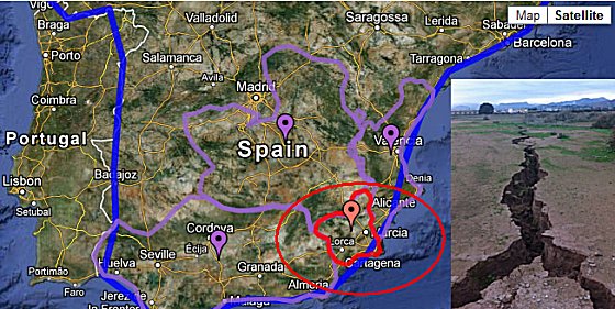
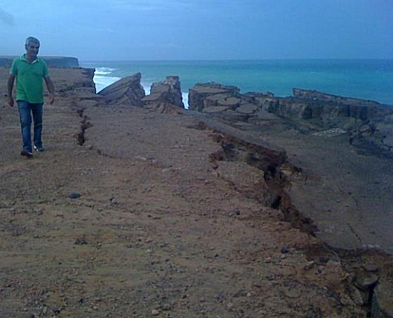
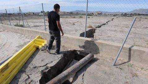
MessageToEagle.com – New dangerous cracks in ground appeared on our planet.

This time, they have been reported in Spain.

The Department of Emergency situations urgently requested the Geological Survey of Murcia to assess the cause of the “huge cracks in ground”, which appeared after the recent heavy rains in the industrial park area “El Saladar”, Totana, situated in the south-east of the Iberian Peninsula.


The crack extends along the industrial park in the direction of the sport city “Valverde Reina”; It has a length of more than 300 meters and a depth of more than two metres in some places.

Crack appeared two days ago and opens gradually reaching a width of 40 to 50 cm.


According to europapress.es at the beginning of November, cracks appeared on top of a cliff at Cotillo, located at the northern end of Fuerteventura, one of the Canary Islands, in the Atlantic Ocean off the coast of Africa.

 Read Full Article Here

Read more…

Unusual Red Auroras

RED AURORAS: Auroras are usually green, and sometimes purple, but seldom do sky watchers see much red. The geomagnetic storm of Nov. 13/14 was different. It produced auroras with a distinctly rosy hue. David E. Cartier, Sr. photographed the phenomenon near Marsh Lake, about 40 km east of Whitehorse in Canada's Yukon Territory:

candycane_strip.jpg

"I was amazed by the deep scarlet color, which was immediately recognizable to the unaided eye," says Cartier. Similar splashes of candy-cane red were spotted over Norway, Wisconsin, and Michigan.

The apparition might be related to rare all-red auroras sometimes seen during intense geomagnetic storms. They occur some 300 to 500 km above Earth's surface and are not yet fully understood. Some researchers believe the red lights are linked to a large influx of low-energy electrons. When such electrons recombine with oxygen ions in the upper atmosphere, red photons are emitted. At present, space weather forecasters cannot predict when this will occur.

Could more reds be in the offing? NOAA estimates a 30% to 35% chance of polar geoagnetic storms on Nov. 16th and 17th. Sky watchers seeing red should submit their images here.

Read more…

Huge Solar Erupton Today; Not Earth Directed

HUMONGOUS ERUPTION: A truly gigantic explosion happened on the sun today. Magnetic fields snaking halfway across the sun's southern hemisphere erupted in tandem, producing a prominence so big, it doesn't fit inside this image from NASA's Observatory (SDO):

humongous_strip.jpg

The blast hurled a CME into space, but the cloud does not appear to be heading for Earth.

A movie of the event, prepared by Steele Hill of the Goddard Space , shows magnetic fields in concerted motion across an expanse of solar "terrain" more than 700,000 km wide. Observations by SDO have shown that such wide-ranging eruptions are not uncommon on the sun--the great Global Eruption of August 2010 being the iconic example.

http://spaceweather.com/

Read more…

US Accepts Keshe Foundation Spaceship Program

But the question remains... for good or for bad?

Thursday, 15 November 2012

Keshe: USA the latest addition to the Keshe Foundation family

Posted: 15 Nov 2012 03:44 PM PST

We are proud to announce that today 15.11.2012 the Nation of United States of America has received the USB stick containing all patents and blueprints of nuclear reactor plasma spaceship technology of the Keshe Foundation.

We welcome our American brothers in the family of the Keshe Foundations' spaceship program and surely we will reach new horizons with the addition of American government and NASA to our family.

Note

Following My letter offering as a gift the spaceship program to the ambassador of USA in Belgium in late October, on the 6.11.2012 at 3.45 pm I was in receipt of an e-mail in response to this friendly offer from the USA embassy in Brussels.

The content of the e-mail from the embassy confirmed that USA is ready to accept the gift of the nuclear reactor plasma spaceship technology of the Keshe Foundation and in return e-mails immediately the date was agreed as was suggested by the embassy.

Today 15.11.2012 at 3pm at the appointed place the director of the Keshe Foundation and the senior officer of the US embassy met in a friendly and cordially manner and the spaceship technology USB stick was handed over to the government of United States of America.

We have offered the US and NASA our full support for their development and deployment of this technology.

With this meeting and exchange of nuclear technology we hope to bring to an end the lasting apparent animosity between the two nations.

We shall build on this progress to bring peace into space for all nations.

I as the director of the Keshe Foundation and an Iranian nuclear scientist, I thank His Excellency president Obama for ordering such a move by his embassy.

In our meeting we have reached and extended the hand of peace from our side to His nation and I hope this will be reciprocated the same by his Excellency president Obama, now that borders have become meaningless with deployment of this new spaceship program and technology.

I thank the American ambassador His Excellency Mr. Gutman for this most gracious move and I am sure the first steps towards peace between two nations as is the wish of Iran has come to take shape.

With Kindest regards to all men of peace

M T Keshe
The director of the Keshe Foundation

Removing The Shackles

http://removingtheshackles.blogspot.ca/

Read more…

5.7 Magintude Earthquake Papua New Guinea

Earth Watch Report - Earthquakes

M5.7 - 168km SE of Lorengau, Papua New Guinea 2012-11-15 08:21:49 UTC

USGS


Earthquake location 3.250°S, 148.176°E


Event Time

  1. 2012-11-15 08:21:49 UTC
  2. 2012-11-15 18:21:49 UTC+10:00 at epicenter
  3. 2012-11-15 02:21:49 UTC-06:00 system time

Location


3.250°S 148.176°E depth=9.9km (6.2mi)

Nearby Cities

  1. 168km (104mi) SE of Lorengau, Papua New Guinea
  2. 300km (186mi) WSW of Kavieng, Papua New Guinea
  3. 335km (208mi) NW of Kimbe, Papua New Guinea
  4. 342km (213mi) NE of Madang, Papua New Guinea
  5. 693km (431mi) N of Port Moresby, Papua New Guinea
Read more…

5.6 Magnitude Earthquake Alaska

Earth Watch Report - Earthquake

M5.6 - 41km SSE of Attu Station, Alaska 2012-11-15 11:22:22 UTC

USGS


Earthquake location 52.485°N, 173.354°E

Event Time

  1. 2012-11-15 11:22:22 UTC
  2. 2012-11-15 01:22:22 UTC-10:00 at epicenter
  3. 2012-11-15 05:22:22 UTC-06:00 system time

Location


52.485°N 173.354°E depth=30.0km (18.7mi)

Nearby Cities

  1. 41km (25mi) SSE of Attu Station, Alaska
  2. 992km (616mi) E of Petropavlovsk-Kamchatskiy, Russia
  3. 1009km (627mi) E of Vilyuchinsk, Russia
  4. 1010km (628mi) E of Yelizovo, Russia
  5. 3205km (1991mi) W of Whitehorse, Canada
Read more…

5.3 Magnitude Earthquake SSE of Hasaki, Japan

Earth Watch Report - Earthquakes

M5.3 - 58km SSE of Hasaki, Japan 2012-11-16 08:25:57 UTC

USGS


Earthquake location 35.231°N, 141.046°E http://www.bugbog.com/images/maps/japan-map.jpg

Event Time

  1. 2012-11-16 08:25:57 UTC
  2. 2012-11-16 17:25:57 UTC+09:00 at epicenter
  3. 2012-11-16 02:25:57 UTC-06:00 system time

Location


35.231°N 141.046°E depth=34.6km (21.5mi)

Nearby Cities

  1. 58km (36mi) SSE of Hasaki, Japan
  2. 60km (37mi) E of Ohara, Japan
  3. 64km (40mi) SSE of Asahi, Japan
  4. 68km (42mi) SE of Yokaichiba, Japan
  5. 132km (82mi) ESE of Tokyo, Japan
Read more…

Blog Topics by Tags

Monthly Archives