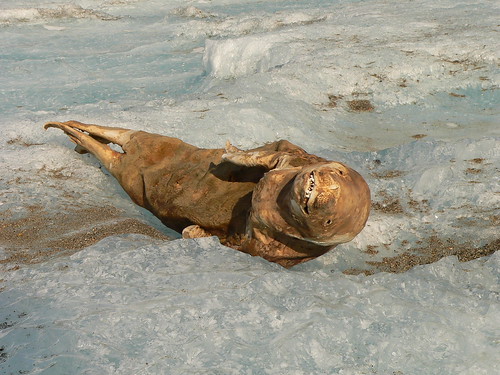
1. Mummified seals in the hills
Antarctica is the only continent on Earth that is shared by various countries. Each has a 'slice' of the pie, so to speak - and military occupation is 'not allowed' although I am sure that can be contested.
Early on when Shackleton, Scott and various other explorers set out to Antarctica some had noticed frozen and mummified seals strewn about. Some seals are found about to 40 miles or more inland, and up to 2000 feet above sea level. To this day, this is a relatively unknown phenomenon because there has been no real concensus as to how or why the seals remain where they do, so far from the shore. Various carbon dating has been done on the seals, and although C4 techniques can yield faulty results in Antarctica, some seals date from roughly 2,600 to 6000 years ago. 
Many are found stripped to the bone, others are mummified - lacking in blubber mass, cut, broken - dirt, sand and rocks lodged in the stomach or some seals are without food. The majority of the seals 'appear' to be rather young, though the mummification process due to cold does shrink the body's.
An explanation? Some scientists think they lost their way - got trapped inland, funnelled up to a point where they would see a glacier and think it ice cover. So they would trek along, 40 miles or more - and eventually die.
How did the seals transport themselves to such heights - so far inland? Some seals show cut marks where they bled, so researchers think they must have fallen off the high cliffs. Would they not be strewn about in more pieces this way?
To explain dirt, rocks and sand in the stomach researchers think they must have eaten it, to stave off starvation from walking so far inland and up hills.
2. Possible structures revealed through melting ice
Most of the photo's i took below I followed through this man's youtube video:
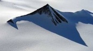
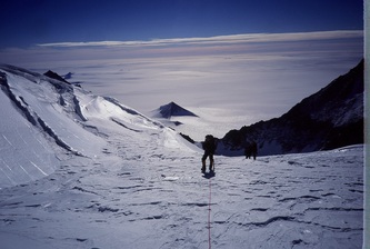
I went through myself and took photo's, then fooled around with the contrast and lighting in photo-shop. I am sure more then not, it is the brain wanting to make patterns. However, some really do look like pyramids, and if higher resolution imagery was available we could really figure this out.
Above: This is the 'Hunter'
Above: A 'Pyramid' Structure I came upon. The Google Earth Co-ordinates are on the bottom, feel free to go check this stuff out yourselves, move around it etc. Is it a pyramid? I do not know, though it is intriguing to think so.
Above: Notice the 'runway' reminiscent of some Nazca Peru pictures I took awhile
Below: Nazca runway photo I took
Above: Another pyramid structure, notice the dome type structure alongside the Pyramid - and there appears to be another smaller 'pyramid' like structure behind the main one
Above: This picture fascinates me - after playing around with the settings in photo-shop and enlarging the area, you can really notice a lot of geometry. It looks like a temple of some sort next to a pyramid!
Above: The left Pyramid highlighted red is the same structure(s) as the photo above this one. To the right there is a giant mound with 'looks' structured in some way. Almost reminds me of the sphinx. To the back which I did not amplify with photo'shop are what 'looks' like 'steps'
These photo's have been floating around the internet causing a buzz. As the ice cover rapidly melts - it is possible that structures will reveal themselves to us - or, as some of the photo's above show - Have (possibly) revealed themselves.
3. Structure off the Coast of Antarctica
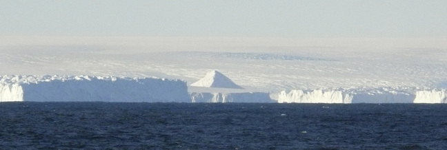
I stumbled upon this earlier - snapped a photo then played around with it in photo-shop. The first thing it reminded me of, were some structures i took pictures of using Google Earth from the Nazca Plains area. See below.
Below are two I took from Nazca, Peru.
4. Tropical Forests of Antarctica
Recently, Geologists discovered more evidence that Antarctica was warm enough in the past to produce forests of Palm trees and other tropical vegetation. This comes as no surprise really, considering coal beds and peat bogs have yielded evidence in the past as well.
ScienceDaily (Aug. 1, 2012) — Given the predicted rise in global temperatures in the coming decades, climate scientists are particularly interested in warm periods that occurred in the geological past. Knowledge of past episodes of global warmth can be used to better understand the relationship between climate change, variations in atmospheric carbon dioxide and the reaction of Earth’s biosphere. An international team led by scientists from the Goethe University and the Biodiversity and Climate Research Centre in Frankfurt, Germany, has discovered an intense warming phase around 52 million years ago in drill cores obtained from the seafloor near Antarctica — a region that is especially important in climate research.
The study published in the journalNature shows that tropical vegetation, including palms and relatives of today’s tropical Baobab trees, was growing on the coast of Antarctica 52 million years ago. These results highlight the extreme contrast between modern and past climatic conditions on Antarctica and the extent of global warmth during periods of elevated atmospheric carbon dioxide levels.
Around 52 million years ago, the concentration of the greenhouse gas carbon dioxide (CO2) in the atmosphere was more than twice as high as today. “If the current CO2emissions continue unabated due to the burning of fossil fuels, CO2concentrations in the atmosphere, as they existed in the distant past, are likely to be achieved within a few hundred years”, explains Prof. Jörg Pross, a paleoclimatologist at the Goethe University and member of the Biodiversity and Climate Research Centre (BiK-F) in Frankfurt, Germany. “By studying naturally occurring climate warming periods in the geological past, our knowledge of the mechanisms and processes in the climate system increases. This contributes enormously to improving our understanding of current human-induced global warming.”
A few inherent problems exist with this model.
1. More evidence discovered that Antarctica was in a sub-tropical location, so how do we account for this? Geologists have to increase the global temperature of the Earth. With no causal explanation.
2. The study was done to better understand current global CO2 emissions, suggesting that if we continue on our current path - the Earth itself could undergo similar scenarios as to what occurred 52 million years ago.
3. Geological study is carried out under the assumption that the present day laws of nature have always been occurring - and yet, the inherent contradiction is that we do not see this phenomenon in play within the natural world today.
4. To provide answers to sub tropical life in Antarctica, either the earth was warmed to such an extent that the current poles could house this life - and if this is the case, where did all the water go? Would not the land masses be covered in water? If not, then Humans must have caused the CO2 emissions 52 million years ago which I think is highly unlikely.
Earth Crustal displacement can offer a better answer, without bringing in multiple causal explanations.
The portion of land in Antarctica where we find tropical forests must have been in a warmer lattitude then it previously is.
Here is a snippet from another article on the Arctic.
Scientist Probes Fossil Oddity: Giant Redwoods near North Pole
Once upon a time, Axel Heiberg Island was a very strange place.
Located in the Arctic Circle north of Canada, a full 8/9ths of the way from the equator to the North Pole, the uninhabited Canadian island is far enough north to make Iceland look like a great spot for a winter getaway, and today there's not much to it beyond miles of rocks, ice, a few mosses, and many fossils.
The fossils tell of a different era, though, an odd time about 45 million years ago when Axel Heiberg, still as close to the North Pole as it is now, was covered in a forest of redwood-like trees known as metasequoias.
Hope Jahren, an assistant professor of earth and planetary sciences in the Krieger School of Arts and Sciences at The Johns Hopkins University, recently published results that partially demystified Axel Heiberg's vanished forests. Jahren and colleague Leo Sternberg of the University of Miami uncovered evidence that the Axel Heiberg's forests probably received equatorial water and warmth from a prehistoric weather pattern unlike anything in existence today.
Other challenging mysteries remain, including how a forest could develop given the sunlight it would receive on Axel Heiberg. Because of its closeness to the North Pole both now and in the time of the redwoods, Axel Heiberg spends four months of each year in continuous sunlight and four months of each year in continuous darkness.
"We don't have plants that can survive under those conditions today, let alone forests," Jahren says. "For a tree to endure four months of daylight is like you or I going without sleep for four months."
Through a grant from the Andrew Mellon Foundation, Jahren's research group has made three summer visits to Axel Heiberg, excavating hundreds of fossil metasequoias. The fossils are immaculately well-preserved.
"Some of this stuff looks about like driftwood on the beach, but it's 45 million years old," Jahren says. "These fossils are chemically preserved at a level you usually would expect to see in something that's only 1,000 years old." That's ideal for Jahren, who studies the presence of isotopes of elements like carbon, nitrogen and oxygen in living and fossilized plants. Isotopes are forms of an element that differ only by the addition of one or more subatomic particles known as neutrons. Different isotopes of the same element have different mass, which affects the way plants use them...
Notice the estimation here - 45 million years ago in the Arctic while Antarctica is 52 million years. So in a 7 million year period, must we then cause the Earth to warm up and cool down several more times? How? What cause?
If any of this is correct - What are the Implications? I am strong proponent of Crust Displacement. To me, mummified seals high up in elevation, miles inland can be explained if the Antarctica continent along the south was either dragged out of the ocean, pulling seals inland - or the ocean water moving over the coastline deep in land, eventually depositing the animals on high cliffs, in valley's - smashing them in the process. This could also explain how a Tropical environment flourished there - part of the continent existed in a warmer latitude at one point, then was dragged to its current location.
The structure on the Left side of the continent, under water, resembles structures in Peru. I am unsure what those are to begin with, but the pattern itself - whether they are evenly spaced holes, or dome type things, suggests a human hand was involved.


Comments
And the mummified people of today wish to vote and teach other people to vote for TPTB. They are alive but they act as if they were long dead? Voting in darkness and voting for darkness? Where is their Spirit they were born with? For almost everyone was born into the Light. Then why do they vote for those angels of darkness? Politics makes cancer seem like a snow cone today! And yet they remain brainwashed and vote?
They have also found whale skeletons in the deserts of Eygpt, hundreds of miles from the Med.
Thanks dude - I came upon the mummified seal thing a few days ago actually and was quite surprised I had not heard of it before. Gonna do more research into it, find some journal articles etc
last great crustal displacement, of around 11500 years ago, thats when Antarctica formed as an ice continent, vast continental drift over period of years or even months.
In a dual island kinda of land mass as antartica is, it would not be hard to believe that the ocean water would over flow 2000 feet. But would a similar pole shift make it all the way to the central U.S with the tidal surges? Which would have to be similar at the coast but might not have the oompf to make it all the way inland on any large continent? This is something to consider when you are planning a prepper community say in idaho, or kansas or wisconsin. Obviously denver might be safe but it will be the HQ of the PTB as well. Just how far inland and at what elevation is a conundrum. If we look at the movie 2012 it is a very good marker of just what may happen. Everything depends on location? Location of the flyby of whatever massive celestial object may be coming? Then whats your location, i believe that a waterproof shipping container buried 35 feet deep in a hill of over 2000 feet above sea level and way inland might provide survivability? At least from the main causes, depending on whether the land mass its on rises or falls? Yet i dont see hardly anyone preparing for such in any of the survival communitys online i have visted. They are preparing for financial collapse, but none i know of are preparing for a poleshift? Being above ground or in a 10 foot trench will most likely not provide survivability, i cant get any of my family members to go as far to prepare. Its basically a no win situation for me, even though many people somewhat believe what i am trying to teach them. LOL
What needs to be taken into consideration, is what caused the Venus and mars conjunction around earth at about 3700 years ago. The we notice that there was another episode 1000 years later? Just like Revelations in the bible says there will be again. So it would seem there is still some outside celestial influence, which is not the Sun! If we consider that the heliosphere is egg shaped and not round, then there is the possibilty that there is a brown dwarf out side of it in a highly elliptical orbit around the Sun and every 3600 years its comes close to the Sun in their mutual orbits? All i can say is either NASA and TPTB are lying to us or they just dont know? I think they do know and we are in for another binary Star conjunction in the near future!