

Craig Morey from Emsworth, Hants, UK
Creative Commons Attribution-Share Alike 2.0 Generic license.

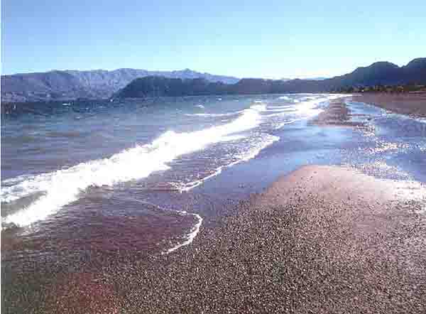
Flickr: Kayakin’ on Colorado River Creative Commons Attribution 2.0 Generic license.
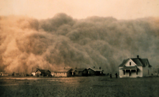
Dust-storm-Texas-1935 - Dust Bowl
NOAA George E. Marsh Album - Public Domain
*********************************************************************************************************
The Colorado River, The High Plains Aquifer And The Entire Western Half Of The U.S. Are Rapidly Drying Up
![]() By Michael, on May 23rd, 2013
By Michael, on May 23rd, 2013

What is life going to look like as our precious water resources become increasingly strained and the western half of the United States becomes bone dry? Scientists tell us that the 20th century was the wettest century in the western half of the country in 1000 years, and now things appear to be reverting to their normal historical patterns. But we have built teeming cities in the desert such as Phoenix and Las Vegas that support millions of people. Cities all over the Southwest continue to grow even as the Colorado River, Lake Mead and the High Plains Aquifer system run dry. So what are we going to do when there isn’t enough water to irrigate our crops or run through our water systems? Already we are seeing some ominous signs that Dust Bowl conditions are starting to return to the region. In the past couple of years we have seen giant dust storms known as “haboobs” roll through Phoenix, and 6 of the 10 worst years for wildfires ever recorded in the United States have all come since the year 2000. In fact, according to the Los Angeles Times, “the average number of fires larger than 1,000 acres in a year has nearly quadrupled in Arizona and Idaho and has doubled in every other Western state” since the 1970s. But scientists are warning that they expect the western United States to become much drier than it is now. What will the western half of the country look like once that happens?
A recent National Geographic article contained the following chilling statement…
The wet 20th century, the wettest of the past millennium, the century when Americans built an incredible civilization in the desert, is over.
Much of the western half of the country has historically been a desolate wasteland. We were very blessed to enjoy very wet conditions for most of the last century, but now that era appears to be over.
To compensate, we are putting a tremendous burden on our fresh water resources. In particular, the Colorado River is becoming increasingly strained. Without the Colorado River, many of our largest cities simply would not be able to function. The following is from a recent Stratfor article…
The Colorado River provides water for irrigation of roughly 15 percent of the crops in the United States, including vegetables, fruits, cotton, alfalfa and hay. It also provides municipal water supplies for large cities, such as Phoenix, Tucson, Los Angeles, San Diego and Las Vegas, accounting for more than half of the water supply in many of these areas.
In particular, water levels in Lake Mead (which supplies most of the water for Las Vegas) have fallen dramatically over the past decade or so. The following is an excerpt from an article posted on Smithsonian.com…
And boaters still roar across Nevada and Arizona’s Lake Mead, 110 miles long and formed by the Hoover Dam. But at the lake’s edge they can see lines in the rock walls, distinct as bathtub rings, showing the water level far lower than it once was—some 130 feet lower, as it happens, since 2000. Water resource officials say some of the reservoirs fed by the river will never be full again.
Today, Lake Mead supplies approximately 85 percent of the water that Las Vegas uses, and since 1998 the water level in Lake Mead has dropped by about 5.6 trillion gallons.
So what happens if Lake Mead continues to dry up?
Well, the truth is that it would be a major disaster…
Way before people run out of drinking water, something else happens: When Lake Mead falls below 1,050 feet, the Hoover Dam’s turbines shut down – less than four years from now, if the current trend holds – and in Vegas the lights start going out.
Ominously, these water woes are not confined to Las Vegas. Under contracts signed by President Obama in December 2011, Nevada gets only 23.37% of the electricity generated by the Hoover Dam. The other top recipients: Metropolitan Water District of Southern California (28.53%); state of Arizona (18.95%); city of Los Angeles (15.42%); and Southern California Edison (5.54%).
**********************************************************************************************************
U.S. Has Depleted Two Lake Eries’ Worth Of Groundwater Since 1900

Over the last century, the U.S. has depleted enough of its underground freshwater supply to fill Lake Erie twice, according to a new study from the U.S. Geological Survey. Here’s another way to understand how much water we’ve used. Just between 2000 and 2008, the latest period in the study and the period of fastest depletion, Americans brought enough water aboveground to contribute to 2 percent of worldwide ocean level rise in that time.
“We think it’s serious,” Leonard Konikow, the U.S. Geological Survey hydrologist who performed the study, tells Popular Science. “It’s more serious in certain areas.”
Lowering aquifers mean less local water for the communities that depend upon them. They can also suck dry springs, wetlands and other surface water features, Konikow wrote in a report the survey published yesterday. Scientists don’t always have a tally for how much water an aquifer holds, however, so it’s more difficult to say what percentage of the U.S.’ overall groundwater is gone. (In some systems, it’s difficult to determine where the bottom of the aquifer is, Konikow explains.)
Related articles
- The Colorado River, The High Plains Aquifer And The Entire Western Half Of The U.S. Are Rapidly Drying Up (silveristhenew.com)
- The Colorado River, The High Plains Aquifer And The Entire Western Half Of The U.S. Are Rapidly Drying Up (theeconomiccollapseblog.com)
- The new bridge over the Colorado River at Hoover Dam… (czarniklife.wordpress.com)
- Colorado River Tops 2013 Endangered Waterways List (sci-tech-today.com)
- The Colorado River, The High Plains Aquifer And The Entire Western Half Of The U.S. Are Rapidly Drying Up (stateofglobe.com)
- The Colorado River, The High Plains Aquifer And The Entire Western Half Of The U.S. Are Rapidly Drying Up (brotherjohnf.com)
- Groundwater woes: U.S. lost two Lake Eries’ worth before 2009 (journalstar.com)
- Climate Change and Anthropogenic Sea Level Potholes (theenergycollective.com)
- Ogallala Aquifer in Texas Panhandle suffers big drop (mywesttexas.com)
- Environment: Water depletion accelerating in key aquifers (summitcountyvoice.com)
Comments