earthquakes (36)

Earth Watch Report - Earthquakes

 
photo Oklahoma-31EQinlast7days03262014_zps97b72426.png

31 earthquakes in map area

  1. M 2.7 - 6km SSW of Langston, Oklahoma

     2014-03-26 09:24:20 UTC-05:00 5.0 km

  2. M 2.6 - 31km WSW of McAlester, Oklahoma

     2014-03-25 15:52:17 UTC-05:00 5.0 km

  3. M 3.4 - 12km NW of Edmond, Oklahoma

     2014-03-25 09:01:19 UTC-05:00 6.1 km

  4. M 2.8 - 4km NNW of Stroud, Oklahoma

     2014-03-24 18:32:46 UTC-05:00 7.8 km

  5. M 2.7 - 10km E of Medford, Oklahoma

     2014-03-24 10:39:59 UTC-05:00 5.0 km

  6. M 2.5 - 21km SSE of Medford, Oklahoma

     2014-03-22 22:37:23 UTC-05:00 5.0 km

  7. M 3.3 - 11km ENE of Medford, Oklahoma

     2014-03-22 14:42:11 UTC-05:00 5.0 km

  8. M 2.9 - 14km SSE of Medford, Oklahoma

     2014-03-22 14:30:12 UTC-05:00 5.0 km

  9. M 3.0 - 19km SSE of Medford, Oklahoma

     2014-03-22 14:15:54 UTC-05:00 5.0 km

  10. M 2.5 - 7km SSW of Langston, Oklahoma

     2014-03-22 13:40:44 UTC-05:00 5.0 km

  11. M 2.8 - 8km ENE of Stillwater, Oklahoma

     2014-03-22 12:43:55 UTC-05:00 5.0 km

  12. M 2.7 - 4km SSW of Langston, Oklahoma

     2014-03-22 10:58:20 UTC-05:00 5.0 km

  13. M 4.0 - 12km S of Langston, Oklahoma

     2014-03-21 22:05:59 UTC-05:00 4.5 km

  14. M 3.1 - 7km SSW of Langston, Oklahoma

     2014-03-21 22:02:35 UTC-05:00 4.5 km

  15. M 3.1 - 7km SSW of Langston, Oklahoma

     2014-03-21 22:01:32 UTC-05:00 7.6 km

  16. M 2.6 - 3km SE of Langston, Oklahoma

     2014-03-21 21:35:01 UTC-05:00 6.9 km

  17. M 2.9 - 4km SSE of Langston, Oklahoma

     2014-03-21 21:30:34 UTC-05:00 5.0 km

  18. M 2.6 - 1km SE of Choctaw, Oklahoma

     2014-03-21 17:41:07 UTC-05:00 6.7 km

  19. M 2.6 - 1km SE of Choctaw, Oklahoma

     2014-03-21 14:59:40 UTC-05:00 5.0 km

  20. M 2.7 - 9km NNW of Yale, Oklahoma

     2014-03-21 14:11:45 UTC-05:00 7.3 km

  21. M 2.7 - 10km N of Guthrie, Oklahoma

     2014-03-21 06:20:54 UTC-05:00 5.0 km

  22. M 2.9 - 15km NNE of Crescent, Oklahoma

     2014-03-21 04:05:46 UTC-05:00 3.8 km

  23. M 2.8 - 9km SE of Cherokee, Oklahoma

     2014-03-21 01:43:13 UTC-05:00 9.7 km

  24. M 2.8 - 14km NNE of Crescent, Oklahoma

     2014-03-21 01:01:32 UTC-05:00 4.3 km

  25. M 2.5 - 9km NW of Prague, Oklahoma

     2014-03-21 00:46:59 UTC-05:00 5.0 km

  26. M 3.3 - 20km NNE of Enid, Oklahoma

     2014-03-20 17:42:32 UTC-05:00 3.9 km

  27. M 2.8 - 5km SSW of Langston, Oklahoma

     2014-03-20 11:48:49 UTC-05:00 4.4 km

  28. M 2.6 - 5km SSW of Langston, Oklahoma

     2014-03-20 11:46:54 UTC-05:00 4.2 km

  29. M 3.2 - 3km S of Langston, Oklahoma

     2014-03-20 09:39:17 UTC-05:00 5.0 km

  30. M 3.1 - 22km SSE of Medford, Oklahoma

     2014-03-20 00:12:23 UTC-05:00 4.4 km

  31. M 2.6 - 21km SSE of Medford, Oklahoma

     2014-03-20 00:08:48 UTC-05:00 3.5 km

....

Instrumental Intensity

ShakeMap Intensity Image


.....

New 9.com

Shake 'Em Up: 4 Earthquakes Roar In Central Oklahoma

Posted: Mar 21, 2014 10:39 PM CST Updated: Mar 21, 2014 10:47 PM CST

Four earthquakes rumbled around central Oklahoma, Friday night.

Four earthquakes rumbled around central Oklahoma, Friday night.

LANGSTON, Oklahoma -

Multiple earthquakes shook up residents in central Oklahoma, Friday night.

The first earthquake struck around 9:35 p.m. and weighed in at a 2.6 on the Richter scale. It was recorded one mile southeast of Langston, or about 34 mile north northeast of the Oklahoma City metro, at a depth of just over three miles.

A second earthquake shook just after 10 p.m. This quake was a 2.8 on the Richter scale and was recorded at a depth of four miles. Its epicenter was located three miles south southwest of Langston.

Then the third and largest earthquake rumbled. At approximately 10:05 p.m., a 4.0 magnitude temblor rattled seven miles south of town at a depth of about two and a half miles.


Read More Here

Enhanced by Zemanta

Read more…

Earth Watch Report  -  Earthquakes

photo California-12EQsMay15-16-172013_zps16676c84.jpg


photo California-12EQsMay15-16-172013photoofEQsinthelast30days_zpsf56593f8.jpg

California – 12 EQs May 15-16-17 2013  photo of  EQs  in the  last  30 days

….

M3.0 – 6km NW of The Geysers, California

 2013-05-15 06:11:55 UTC


Earthquake location 38.819°N, 122.804°W

Event Time

  1. 2013-05-15 06:11:55 UTC
  2. 2013-05-14 23:11:55 UTC-07:00 at epicenter
  3. 2013-05-15 01:11:55 UTC-05:00 system time

Location

38.819°N 122.804°W depth=4.0km (2.5mi)

Nearby Cities

  1. 6km (4mi) NW of The Geysers, California
  2. 21km (13mi) SW of Clearlake, California
  3. 23km (14mi) NNE of Healdsburg, California
  4. 30km (19mi) N of Windsor, California
  5. 116km (72mi) WNW of Sacramento, California


….

M3.1 – 7km NNE of Cabazon, California

 2013-05-15 16:20:05 UTC


Earthquake location 33.980°N, 116.767°W

Event Time

  1. 2013-05-15 16:20:05 UTC
  2. 2013-05-15 09:20:05 UTC-07:00 at epicenter
  3. 2013-05-15 11:20:05 UTC-05:00 system time

Location

33.980°N 116.767°W depth=17.9km (11.1mi)

Nearby Cities

  1. 7km (4mi) NNE of Cabazon, California
  2. 11km (7mi) ENE of Banning, California
  3. 20km (12mi) ENE of Beaumont, California
  4. 24km (15mi) W of Desert Hot Springs, California
  5. 438km (272mi) W of Phoenix, Arizona


….

M4.0 – 10km S of Rancho Palos Verdes, California

 2013-05-15 20:00:06 UTC


Earthquake location 33.658°N, 118.372°W

Event Time

  1. 2013-05-15 20:00:06 UTC
  2. 2013-05-15 13:00:06 UTC-07:00 at epicenter
  3. 2013-05-15 15:00:06 UTC-05:00 system time

Location

33.658°N 118.372°W depth=1.2km (0.7mi)

Nearby Cities

  1. 10km (6mi) S of Rancho Palos Verdes, California
  2. 12km (7mi) SW of San Pedro, California
  3. 16km (10mi) SSW of Lomita, California
  4. 16km (10mi) S of Palos Verdes Estates, California
  5. 586km (364mi) W of Phoenix, Arizona


….

Instrumental Intensity

ShakeMap Intensity Image


….

M2.6 – 17km E of Willows, California

 2013-05-15 22:15:50 UTC


Earthquake location 39.508°N, 121.988°W

Event Time

  1. 2013-05-15 22:15:50 UTC
  2. 2013-05-15 15:15:50 UTC-07:00 at epicenter
  3. 2013-05-15 17:15:50 UTC-05:00 system time

Location

39.508°N 121.988°W depth=22.6km (14.0mi)

Nearby Cities

  1. 17km (11mi) E of Willows, California
  2. 27km (17mi) SSW of Chico, California
  3. 37km (23mi) W of Oroville, California
  4. 42km (26mi) SW of Paradise, California
  5. 111km (69mi) NNW of Sacramento, California


….

M2.9 – 8km SSE of Aguanga, California

 2013-05-16 00:30:33 UTC


Earthquake location 33.373°N, 116.841°W

Event Time

  1. 2013-05-16 00:30:33 UTC
  2. 2013-05-15 17:30:33 UTC-07:00 at epicenter
  3. 2013-05-15 19:30:33 UTC-05:00 system time

Location

33.373°N 116.841°W depth=6.6km (4.1mi)

Nearby Cities

  1. 8km (5mi) SSE of Aguanga, California
  2. 31km (19mi) ESE of Temecula, California
  3. 36km (22mi) NE of Escondido, California
  4. 36km (22mi) N of Ramona, California
  5. 443km (275mi) W of Phoenix, Arizona


….

M3.2 – 7km W of Pine Mountain Club, California

 2013-05-16 10:04:58 UTC


Earthquake location 34.858°N, 119.239°W

Event Time

  1. 2013-05-16 10:04:58 UTC
  2. 2013-05-16 03:04:58 UTC-07:00 at epicenter
  3. 2013-05-16 05:04:58 UTC-05:00 system time

Location

34.858°N 119.239°W depth=12.7km (7.9mi)

Nearby Cities

  1. 7km (4mi) W of Pine Mountain Club, California
  2. 53km (33mi) SSW of Lamont, California
  3. 54km (34mi) SW of Arvin, California
  4. 57km (35mi) NNE of Carpinteria, California
  5. 459km (285mi) SSE of Sacramento, California


….

M2.6 – 8km NW of Kettleman City, California

 2013-05-17 02:39:50 UTC

Earthquake location 36.068°N, 120.012°W

Event Time

  1. 2013-05-17 02:39:50 UTC
  2. 2013-05-16 19:39:50 UTC-07:00 at epicenter
  3. 2013-05-16 21:39:50 UTC-05:00 system time

Location

36.068°N 120.012°W depth=62.0km (38.5mi)

Nearby Cities

  1. 8km (5mi) NW of Kettleman City, California
  2. 12km (7mi) NE of Avenal, California
  3. 32km (20mi) ESE of Coalinga, California
  4. 33km (21mi) SW of Lemoore, California
  5. 308km (191mi) SSE of Sacramento, California


….

M3.5 – 5km SW of Niland, California

 2013-05-17 03:07:52 UTC


Earthquake location 33.203°N, 115.550°W

Event Time

  1. 2013-05-17 03:07:52 UTC
  2. 2013-05-16 20:07:52 UTC-07:00 at epicenter
  3. 2013-05-16 22:07:52 UTC-05:00 system time

Location

33.203°N 115.550°W depth=1.9km (1.2mi)

Nearby Cities

  1. 5km (3mi) SW of Niland, California
  2. 24km (15mi) N of Brawley, California
  3. 39km (24mi) N of Imperial, California
  4. 45km (28mi) N of El Centro, California
  5. 324km (201mi) W of Phoenix, Arizona


….


….

M3.1 – 4km SW of Niland, California

 2013-05-17 04:38:13 UTC


Earthquake location 33.212°N, 115.552°W

Event Time

  1. 2013-05-17 04:38:13 UTC
  2. 2013-05-16 21:38:13 UTC-07:00 at epicenter
  3. 2013-05-16 23:38:13 UTC-05:00 system time

Location

33.212°N 115.552°W depth=1.8km (1.1mi)

Nearby Cities

  1. 4km (2mi) SW of Niland, California
  2. 26km (16mi) N of Brawley, California
  3. 40km (25mi) N of Imperial, California
  4. 46km (29mi) N of El Centro, California
  5. 324km (201mi) W of Phoenix, Arizona


….

M2.7 – 4km SW of Niland, California

 2013-05-17 05:18:29 UTC


Earthquake location 33.208°N, 115.546°W

Event Time

  1. 2013-05-17 05:18:29 UTC
  2. 2013-05-16 22:18:29 UTC-07:00 at epicenter
  3. 2013-05-17 00:18:29 UTC-05:00 system time

Location

33.208°N 115.546°W depth=0.0km (0.0mi)

Nearby Cities

  1. 4km (2mi) SW of Niland, California
  2. 25km (16mi) N of Brawley, California
  3. 40km (25mi) N of Imperial, California
  4. 46km (29mi) N of El Centro, California
  5. 324km (201mi) W of Phoenix, Arizona


….

M3.0 – 30km S of Mammoth Lakes, California

 2013-05-17 18:53:20 UTC

Earthquake location 37.378°N, 119.038°W

Event Time

  1. 2013-05-17 18:53:20 UTC
  2. 2013-05-17 11:53:20 UTC-07:00 at epicenter
  3. 2013-05-17 13:53:20 UTC-05:00 system time

Location

37.378°N 119.038°W depth=10.8km (6.7mi)

Nearby Cities

  1. 30km (19mi) S of Mammoth Lakes, California
  2. 85km (53mi) NE of Clovis, California
  3. 87km (54mi) NNE of Sanger, California
  4. 94km (58mi) NNE of Reedley, California
  5. 208km (129mi) SSE of Carson City, Nevada


….

M2.6 – 4km NW of The Geysers, California

2013-05-18 00:11:00 UTC


Earthquake location 38.806°N, 122.791°W

Event Time

  1. 2013-05-18 00:11:00 UTC
  2. 2013-05-17 17:11:00 UTC-07:00 at epicenter
  3. 2013-05-17 19:11:00 UTC-05:00 system time

Location

38.806°N 122.791°W depth=1.3km (0.8mi)

Nearby Cities

  1. 4km (2mi) NW of The Geysers, California
  2. 22km (14mi) SW of Clearlake, California
  3. 22km (14mi) NNE of Healdsburg, California
  4. 28km (17mi) N of Windsor, California
  5. 115km (71mi) WNW of Sacramento, California


….


California – 2 Earthquakes Ranging From 2.6 to 2.5 Magnitude May 13th – 14th 2013 : Total of 44 EQ’s in the last 18 days.


….

California – 5 Earthquakes Ranging From 3.5 to 2.5 Magnitude May 10th 2013 : Total of 42 EQ’s in the last 15 days.

….

California  -  12 Earthquakes  Ranging From 3.6 to 2.5  Magnitude  May 5th to 9th , 2013 :  Total of  37 EQ’s in the  last  14  days. 

California  -  5 Earthquakes  Ranging From 3.2 to 2.5  Magnitude  May 3rd , 2013 :  Total of  25 EQ’s in the  last  six  days.  None were  registered for May 4th, 2013

California  -  3 Low Intensity Earthquakes  Ranging From 2.5 to 2.8  Magnitude  May 2nd , 2013 :  Total of  20 EQ’s in the  last  four  days

California -   5  Earthquakes Ranging from 3.9 to 2.5 Magnitude  May 1st ,  2013.  : Total  of  17 EQ’s in the last  three days

California – 10 Earthquakes Ranging Between 2.5 and 3.0 Registered April 29th,2013

California 2 Earthquakes 2.5 and a 3.0 Magnitude : Total of 12 EQ’s in the last 2 days

Read more…

Indonesia - 25 EQ’s in the last 12 days

Earth Watch Report  -  Earthquakes

photo Indonesia-7EQsMay15-172013_zps95055260.jpg

….

M4.8 – 167km WSW of Sibolga, Indonesia

2013-05-15 10:22:17 UTC


Earthquake location 1.059°N, 97.440°E

Event Time

  1. 2013-05-15 10:22:17 UTC
  2. 2013-05-15 17:22:17 UTC+07:00 at epicenter
  3. 2013-05-15 05:22:17 UTC-05:00 system time

Location

1.059°N 97.440°E depth=41.7km (25.9mi)

Nearby Cities

  1. 167km (104mi) WSW of Sibolga, Indonesia
  2. 196km (122mi) SE of Sinabang, Indonesia
  3. 206km (128mi) W of Padangsidempuan, Indonesia
  4. 254km (158mi) SSW of Kabanjahe, Indonesia
  5. 525km (326mi) WSW of Kuala Lumpur, Malaysia


….

M4.6 – 255km S of Sidorukun, Indonesia

2013-05-15 14:24:00 UTC


Earthquake location 10.880°S, 113.842°E

Event Time

  1. 2013-05-15 14:24:00 UTC
  2. 2013-05-15 22:24:00 UTC+08:00 at epicenter
  3. 2013-05-15 09:24:00 UTC-05:00 system time

Location

10.880°S 113.842°E depth=10.0km (6.2mi)

Nearby Cities

  1. 255km (158mi) S of Sidorukun, Indonesia
  2. 275km (171mi) S of Muncar, Indonesia
  3. 277km (172mi) S of Gambiran Satu, Indonesia
  4. 278km (173mi) S of Srono, Indonesia
  5. 927km (576mi) SE of Jakarta, Indonesia


….

M4.7 – 19km ENE of Bonjol, Indonesia

2013-05-16 01:11:28 UTC


Earthquake location 0.041°N, 100.393°E

Event Time

  1. 2013-05-16 01:11:28 UTC
  2. 2013-05-16 08:11:28 UTC+07:00 at epicenter
  3. 2013-05-15 20:11:28 UTC-05:00 system time

Location

0.041°N 100.393°E depth=157.2km (97.7mi)

Nearby Cities

  1. 19km (12mi) ENE of Bonjol, Indonesia
  2. 38km (24mi) N of Bukittinggi, Indonesia
  3. 39km (24mi) NW of Payakumbuh, Indonesia
  4. 79km (49mi) NNE of Pariaman, Indonesia
  5. 371km (231mi) SSW of Kuala Lumpur, Malaysia


….

M4.4 – South of Java, Indonesia

2013-05-16 16:26:55 UTC


Earthquake location 11.601°S, 113.644°E

Event Time

  1. 2013-05-16 16:26:55 UTC
  2. 2013-05-17 00:26:55 UTC+08:00 at epicenter
  3. 2013-05-16 11:26:55 UTC-05:00 system time

Location

11.601°S 113.644°E depth=4.9km (3.1mi)

Nearby Cities

  1. 337km (209mi) S of Sidorukun, Indonesia
  2. 358km (222mi) SSW of Muncar, Indonesia
  3. 358km (222mi) S of Gambiran Satu, Indonesia
  4. 359km (223mi) SSW of Kuta, Indonesia
  5. 955km (593mi) SE of Jakarta, Indonesia


….

M4.2 – 35km W of Padangsidempuan, Indonesia

 2013-05-17 21:27:56 UTC


Earthquake location 1.359°N, 98.946°E

Event Time

  1. 2013-05-17 21:27:56 UTC
  2. 2013-05-18 04:27:56 UTC+07:00 at epicenter
  3. 2013-05-17 16:27:56 UTC-05:00 system time

Location

1.359°N 98.946°E depth=115.8km (72.0mi)

Nearby Cities

  1. 35km (22mi) W of Padangsidempuan, Indonesia
  2. 46km (29mi) SSE of Sibolga, Indonesia
  3. 117km (73mi) SW of Bandar, Indonesia
  4. 128km (80mi) SW of Rantauprapat, Indonesia
  5. 363km (226mi) WSW of Kuala Lumpur, Malaysia


….

Indonesia  – 8  Earthquakes 5.7  to 4.2 Magnitude  May 12th -14th , 2013.  Total of 25 EQ’s in the last 12 days  ….


….

Indonesia – 2 Earthquakes 5.0 to 4.4 Magnitude May 10th and 11th , 2013. Total of 17 EQ’s in the last 9 days .

….

Indonesia  -  6  Earthquakes  Ranging From  5.0 to 4.4 Magnitude  May 8th to 9th , 2013.   Total of 15 EQ’s in the last 7 days

….

Indonesia- 6 Earthquakes Ranging From 5.0 to 4.5 Magnitude May 3rd and 4th , 2013. Total of 9 EQ’s in the last 3 days

….

Indonesia- 3 Earthquakes Ranging From 5.3 to 4.3 Magnitude May 2nd , 2013

….

Read more…

Earth Watch Report

Dangerous changes on earth: New huge land cracks. This time in Spain,

Above Top Secret

Remember the 2011 Lorca(Murcia) earthquake from 11 may 2011.
With a magnitude of 5.1 at only a depht of 1 km.
Lots of buildings and historical monuments were damaged, 10 deaths and over 400 people were injured.

Now in that same region the earth is cracking up.

The crack extends along the industrial park in the direction of the sport city “Valverde Reina”; It has a length of more than 300 meters and a depth of more than two metres in some places.

According to europapress.es at the beginning of November, cracks appeared on top of a cliff at Cotillo, located at the northern end of Fuerteventura, one of the Canary Islands, in the Atlantic Ocean off the coast of Africa.


link
If those are the same cracks that are showing on the mainland I would imagine more cracks will appear on that line. The distance between the island and the place where the cracks are reported in Murcia is over 2000km.

What the cause may be it still a mystery, as there hasn’t been any recent earthquakes in the region.
Unless it’s been caused by the 2011 earthquake and the volcano activity on the Canary Islands.
Could these be linked?

The Department of Emergency situations urgently requested the Geological Survey of Murcia to assess the cause of the “huge cracks in ground”, which appeared after the recent heavy rains in the industrial park area “El Saladar”, Totana, situated in the south-east of the Iberian Peninsula.


Fractures in the ground often occur during earthquakes. They appear frequently and their origin is not a mystery.
However, fractures not associated with known earthquake movements, are relatively rare and usually remain – unexplained

1 month ago cracks were showing up after the floods of September which caused the life of 3 people. This crack is extending up to 1.5 km and at some places a depht of 5meters. There are no conclusions made of what the cause may be.

The month of October, in El Esparragal, a crack of 1.5 kilometres appeared, that came to light after disappearing water from the floods of September.
The crack affects both houses as farms. Technical Civil Protection and the Geological Survey of Spain moved a few days ago to the place to make a first assessment, but there are no conclusions. A “comprehensive study” is required to analyze the situation, according to the abc.es.


Today the cracks are still growing in some areas and are now up to 50 cm wide. They are closing of the area to avoid any accident by other geological hazards in that region.
Living in Spain, I will follow this and will add updates to this thread if conclusions are made or more cracks appear.
All information and opinions are welcome.

Article and video
Link


Dangerous Changes On Earth -
New Huge Land Cracks This Time In Spain


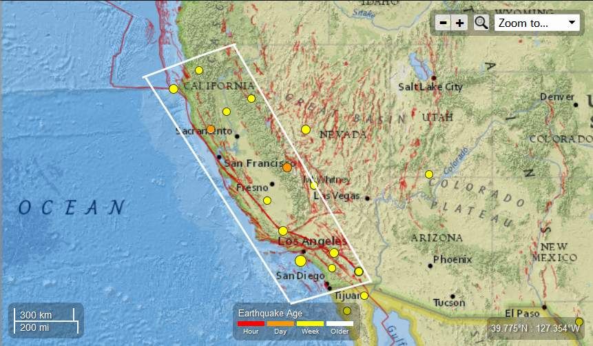
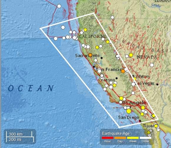
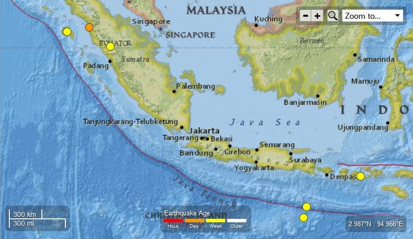
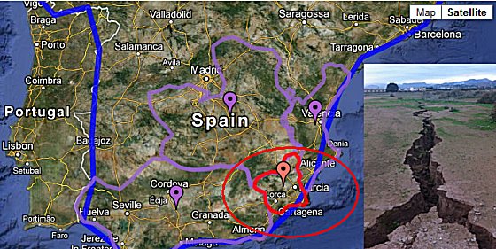
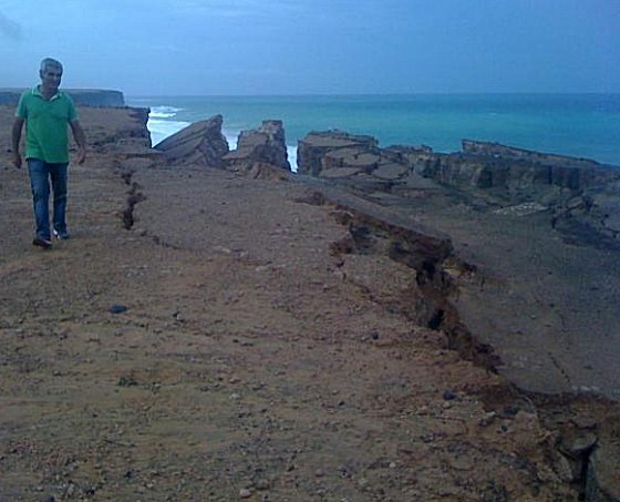
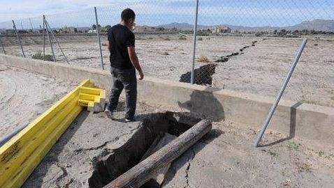
MessageToEagle.com – New dangerous cracks in ground appeared on our planet.

This time, they have been reported in Spain.

The Department of Emergency situations urgently requested the Geological Survey of Murcia to assess the cause of the “huge cracks in ground”, which appeared after the recent heavy rains in the industrial park area “El Saladar”, Totana, situated in the south-east of the Iberian Peninsula.


The crack extends along the industrial park in the direction of the sport city “Valverde Reina”; It has a length of more than 300 meters and a depth of more than two metres in some places.

Crack appeared two days ago and opens gradually reaching a width of 40 to 50 cm.


According to europapress.es at the beginning of November, cracks appeared on top of a cliff at Cotillo, located at the northern end of Fuerteventura, one of the Canary Islands, in the Atlantic Ocean off the coast of Africa.

 Read Full Article Here

Read more…

3MIN News Sept 25. 2012


Published on Sep 25, 2012 by Suspicious0bservers

2012 Pole Shift Video: http://youtu.be/uI10tKuLtFU

TODAY'S LINKS
GOES14 Takes the Stage: http://www.nnvl.noaa.gov/MediaDetail2.php?MediaID=1195&MediaTypeID=1
Jupiter Explosion: http://phys.org/news/2012-09-explosion-jupiter.html
Arab Cyclones: http://phys.org/news/2012-09-tropical-cyclones-arabian-sea-due.html
Arctic Methane Mission: http://phys.org/news/2012-09-methane-gas-arctic-seafloor.html
Great Barrier Reef Climate Change: http://phys.org/news/2012-09-climate-great-barrier-reef.html
Grim Prediction: http://phys.org/news/2012-09-arctic-ice-cap.html
Europa Water: http://www.astrobio.net/pressrelease/5043/water-near-europas-surface-doesnt-s...

REPEAT LINKS
Spaceweather: http://spaceweather.com/[Look on the left at the X-ray Flux and Solar Wind Speed/Density]

HAARP: http://www.haarp.alaska.edu/haarp/data.html[Click online data, and have a little fun]

SDO: http://sdo.gsfc.nasa.gov/data/[Place to find Solar Images and Videos - as seen from earth]

SOHO: http://sohodata.nascom.nasa.gov/cgi-bin/soho_movie_theater[SOHO; Lasco and EIT - as seen from earth]

Stereo: http://stereo.gsfc.nasa.gov/cgi-bin/images[Stereo; Cor, EUVI, HI - as seen from the side]

SunAEON:http://www.sunaeon.com/#/solarsystem/[Just click it... trust me]

SOLARIMG: http://solarimg.org/artis/[All purpose data viewing site]

iSWA: http://iswa.gsfc.nasa.gov/iswa/iSWA.html[Free Application; for advanced sun watchers]

NASA ENLIL SPIRAL: http://iswa.gsfc.nasa.gov:8080/IswaSystemWebApp/iSWACygnetStreamer?timestamp=...
NOAA ENLIL SPIRAL: http://www.swpc.noaa.gov/wsa-enlil/

US Wind Map: http://hint.fm/wind/

NOAA Bouys: http://www.ndbc.noaa.gov/

NOAA Environmental Visualization Laboratory: http://www.nnvl.noaa.gov/Default.php

RSOE: http://hisz.rsoe.hu/alertmap/index2.php[That cool alert map I use]

GOES Xray: http://www.swpc.noaa.gov/sxi/goes15/index.html

JAPAN Radiation Map: http://jciv.iidj.net/map/

LISS: http://earthquake.usgs.gov/monitoring/operations/heliplots_gsn.php

Gamma Ray Bursts: http://grb.sonoma.edu/[Really? You can't figure out what this one is for?]

BARTOL Cosmic Rays: http://neutronm.bartol.udel.edu//spaceweather/welcome.html[Top left box, look for BIG blue circles]

TORCON: http://www.weather.com/news/tornado-torcon-index[Tornado Forecast for the day]

GOES Weather: http://rsd.gsfc.nasa.gov/goes/[Clouds over America]

RAIN RECORDS: http://www.cocorahs.org/ViewData/ListIntensePrecipReports.aspx

EL DORADO WORLD WEATHER MAP: http://www.eldoradocountyweather.com/satellite/ssec/world/world-composite-ir-...

PRESSURE MAP: http://www.woweather.com/cgi-bin/expertcharts?LANG=us&MENU=0000000000&...

HURRICANE TRACKER: http://www.weather.com/weather/hurricanecentral/tracker

INTELLICAST: http://www.intellicast.com/[Weather site used by many youtubers]

NASA News: http://science.nasa.gov/science-news/science-at-nasa/

PHYSORG: http://phys.org/[GREAT News Site!]

QUAKES LIST FULL: http://www.emsc-csem.org/Earthquake/seismologist.php


Read more…

14 DAYS OF GLOBAL CATACLYSM AUGUST 2012

Published on Aug 16, 2012 by fidockave213

Note this video does not imply the world is going to end in 2012......
EXTREME WEATHER and EARTHCHANGES......EARTHQUAKES SINKHOLES FLOODS DROUGHT SNOW ANIMAL KILLS ETC
14 DAYS OF GLOBAL CATACLYSM AUGUST 2012

credit - Glacier footage - https://www.youtube.com/user/Barbecueengineer


The  latter  half  of  August

Fireballs impacting the ground

Honduras Investigates Alleged Meteorite Crash

Large meteorites found after fireball lands in Manitoba, Canada

Meteorite starts fire in Itatiba, Brazil following separate Fireball incident in neighbouring Campinas days earlier

Meteorite hits moving car in Sioux City

More strange sky sounds

More strange sky sounds, Sao Paulo, Brazil

Strange Sounds Over Suffern, New York

Strange Sounds in Germany

Multiple tornadoes/waterspouts

Nine waterspouts spotted on Lake Michigan

Multiple waterspouts touch down in Black Sea, near Foros, Ukraine

Multiple waterspouts touch down off Polish coast

Unusual lightning strikes

Lightning kills two brothers in Russia's Kursk region

3 Lightning strike survivors on Mt Whitney, CA: 'We thought we were on fire'

Lightning injures 10 New Jersey soldiers at New York's Ft. Drum

Lightning-sparked huge fire burns to edge of 3 small California towns

Authorities ID Wisconsin boy killed in lightning strike

Increase in Lightning Observed Across Japan... What the Hell Is That?!

Five seriously injured in French lightning strike

Lightning Strike Kills Wisconsin Boy, 9, and Injures Seven Others on Sailboat

Read more…

Earthquakes & Volcanic Activity

Earthquakes

RSOE  EDIS

Date/Time (UTC) Magnitude Area Country State/Prov./Gov. Location Risk Source Details
24.08.2012 05:56:57 2.3 North America United States Alaska Petersville VulkĂĄn 0 VulkĂĄn 0 VulkĂĄn 0 USGS-RSOE Details
24.08.2012 05:50:58 2.4 North America United States Hawaii Fern Forest There are volcano(s) nearby the epicenter. VulkĂĄn 0 VulkĂĄn 0 USGS-RSOE Details
24.08.2012 05:55:45 2.6 Europe Greece Peloponnese Methoni VulkĂĄn 0 There are airport(s) nearby the epicenter. VulkĂĄn 0 EMSC Details
24.08.2012 05:56:05 4.1 Europe Greece Peloponnese Methoni VulkĂĄn 0 VulkĂĄn 0 VulkĂĄn 0 EMSC Details
24.08.2012 04:20:30 2.6 North America United States Alaska Anchor Point There are volcano(s) nearby the epicenter. VulkĂĄn 0 VulkĂĄn 0 USGS-RSOE Details
24.08.2012 04:50:20 2.3 Europe Czech Republic Horni Sucha VulkĂĄn 0 There are airport(s) nearby the epicenter. VulkĂĄn 0 EMSC Details
24.08.2012 03:05:36 2.5 North America United States California Mammoth Lakes There are volcano(s) nearby the epicenter. VulkĂĄn 0 VulkĂĄn 0 USGS-RSOE Details
24.08.2012 03:50:19 2.5 Europe Greece West Greece Kaminia VulkĂĄn 0 There are airport(s) nearby the epicenter. VulkĂĄn 0 EMSC Details
24.08.2012 02:20:24 2.3 North America United States California Redwood Valley There are volcano(s) nearby the epicenter. VulkĂĄn 0 VulkĂĄn 0 USGS-RSOE Details
24.08.2012 02:10:28 2.4 North America United States California Pearsonville There are volcano(s) nearby the epicenter. There are airport(s) nearby the epicenter. VulkĂĄn 0 USGS-RSOE Details
24.08.2012 01:10:27 2.0 North America United States Alaska Lake Minchumina VulkĂĄn 0 VulkĂĄn 0 VulkĂĄn 0 USGS-RSOE Details
24.08.2012 00:40:24 3.1 Europe Greece West Greece Andritsaina VulkĂĄn 0 There are airport(s) nearby the epicenter. VulkĂĄn 0 EMSC Details
24.08.2012 02:45:31 2.1 Asia Turkey Van Yuvacik There are volcano(s) nearby the epicenter. There are airport(s) nearby the epicenter. VulkĂĄn 0 EMSC Details
24.08.2012 02:45:53 2.1 Asia Turkey Van Yuvacik VulkĂĄn 0 There are airport(s) nearby the epicenter. VulkĂĄn 0 EMSC Details
24.08.2012 00:25:30 2.1 North America Canada British Columbia Princeton VulkĂĄn 0 There are airport(s) nearby the epicenter. VulkĂĄn 0 USGS-RSOE Details
24.08.2012 01:45:44 2.1 Europe Greece North Aegean Agios Dimitrios VulkĂĄn 0 There are airport(s) nearby the epicenter. VulkĂĄn 0 EMSC Details
24.08.2012 03:25:26 3.3 North America United States Alaska False Pass VulkĂĄn 0 VulkĂĄn 0 VulkĂĄn 0 USGS-RSOE Details
23.08.2012 22:40:22 2.1 Europe Italy Sicily Panarea There are volcano(s) nearby the epicenter. There are airport(s) nearby the epicenter. VulkĂĄn 0 EMSC Details
23.08.2012 23:40:26 2.2 Europe Czech Republic Albrechtice VulkĂĄn 0 There are airport(s) nearby the epicenter. VulkĂĄn 0 EMSC Details
23.08.2012 22:40:50 2.6 Europe Italy Veneto Galzignano VulkĂĄn 0 There are airport(s) nearby the epicenter. VulkĂĄn 0 EMSC Details
23.08.2012 22:41:12 2.0 Asia Turkey Edirne Enez VulkĂĄn 0 There are airport(s) nearby the epicenter. VulkĂĄn 0 EMSC Details
23.08.2012 21:40:25 3.0 South-America Chile Maule Molina VulkĂĄn 0 There are airport(s) nearby the epicenter. VulkĂĄn 0 EMSC Details
23.08.2012 21:40:47 2.4 Europe Italy Emilia-Romagna San Prospero VulkĂĄn 0 There are airport(s) nearby the epicenter. VulkĂĄn 0 EMSC Details
23.08.2012 22:41:56 4.2 Indonesian Archipelago Indonesia Maluku Utara Tobelo VulkĂĄn 0 There are airport(s) nearby the epicenter. VulkĂĄn 0 EMSC Details
23.08.2012 20:56:11 2.6 Middle America Mexico Baja California Progreso There are volcano(s) nearby the epicenter. There are airport(s) nearby the epicenter. VulkĂĄn 0 USGS-RSOE Details
23.08.2012 20:40:21 3.3 Europe Romania Racovita VulkĂĄn 0 There are airport(s) nearby the epicenter. VulkĂĄn 0 EMSC Details
23.08.2012 20:40:43 2.4 Europe Italy Calabria Salerni VulkĂĄn 0 VulkĂĄn 0 VulkĂĄn 0 EMSC Details
23.08.2012 19:30:32 2.8 North America United States Alaska Aleneva There are volcano(s) nearby the epicenter. VulkĂĄn 0 VulkĂĄn 0 USGS-RSOE Details
23.08.2012 19:30:56 2.6 North America United States Alaska Mentasta Lake VulkĂĄn 0 VulkĂĄn 0 VulkĂĄn 0 USGS-RSOE Details
23.08.2012 19:35:24 4.6 Indonesian Archipelago Indonesia Komodo VulkĂĄn 0 VulkĂĄn 0 VulkĂĄn 0 EMSC Details
23.08.2012 19:35:48 2.1 Montenegro Trsa VulkĂĄn 0 There are airport(s) nearby the epicenter. VulkĂĄn 0 EMSC Details
23.08.2012 19:01:24 5.0 North Pole Nepal Tulsipur VulkĂĄn 0 VulkĂĄn 0 VulkĂĄn 0 USGS-RSOE Details
23.08.2012 19:36:08 5.1 Asia Nepal Tulsipur VulkĂĄn 0 VulkĂĄn 0 VulkĂĄn 0 EMSC Details
23.08.2012 17:35:30 3.4 North America United States Alaska Aleneva There are volcano(s) nearby the epicenter. VulkĂĄn 0 VulkĂĄn 0 USGS-RSOE Details
23.08.2012 18:30:47 2.4 Europe Italy Emilia-Romagna Solignano Nuovo VulkĂĄn 0 There are airport(s) nearby the epicenter. VulkĂĄn 0 EMSC Details
23.08.2012 17:20:28 2.1 North America United States Hawaii Waimea There are volcano(s) nearby the epicenter. VulkĂĄn 0 VulkĂĄn 0 USGS-RSOE Details
23.08.2012 17:25:26 2.0 Asia Turkey Mu?la Yatagan VulkĂĄn 0 There are airport(s) nearby the epicenter. VulkĂĄn 0 EMSC Details
23.08.2012 18:31:28 3.7 Europe Russia Sakhalin Vostok VulkĂĄn 0 VulkĂĄn 0 VulkĂĄn 0 EMSC Details
23.08.2012 17:25:48 3.8 Asia Kazakhstan Zhambyl Khantau VulkĂĄn 0 VulkĂĄn 0 VulkĂĄn 0 EMSC Details
23.08.2012 16:15:33 2.4 North America United States Alaska Ugashik There are volcano(s) nearby the epicenter. VulkĂĄn 0 VulkĂĄn 0 USGS-RSOE Details
23.08.2012 16:16:01 2.1 North America United States California Cobb There are volcano(s) nearby the epicenter. VulkĂĄn 0 VulkĂĄn 0 USGS-RSOE Details
23.08.2012 16:25:21 3.2 Europe Greece Crete Platanos VulkĂĄn 0 There are airport(s) nearby the epicenter. VulkĂĄn 0 EMSC Details
23.08.2012 15:10:39 2.1 North America United States Alaska Ninilchik There are volcano(s) nearby the epicenter. VulkĂĄn 0 VulkĂĄn 0 USGS-RSOE Details
23.08.2012 13:10:35 2.2 North America United States California Indio Hills VulkĂĄn 0 There are airport(s) nearby the epicenter. VulkĂĄn 0 USGS-RSOE Details
23.08.2012 13:25:51 4.4 Asia Russia Shikotan VulkĂĄn 0 VulkĂĄn 0 VulkĂĄn 0 USGS-RSOE Details
23.08.2012 14:20:19 4.8 Europe Russia Shikotan VulkĂĄn 0 VulkĂĄn 0 VulkĂĄn 0 EMSC Details
23.08.2012 13:45:38 4.7 Pacific Ocean Fiji Northern Lambasa VulkĂĄn 0 VulkĂĄn 0 VulkĂĄn 0 USGS-RSOE Details
23.08.2012 14:20:47 4.6 Pacific Ocean – East Fiji Northern Lambasa VulkĂĄn 0 VulkĂĄn 0 VulkĂĄn 0 EMSC Details
23.08.2012 19:36:43 2.3 North America United States California Furnace Creek VulkĂĄn 0 VulkĂĄn 0 VulkĂĄn 0 USGS-RSOE Details
23.08.2012 12:10:34 2.3 North America United States California Furnace Creek VulkĂĄn 0 VulkĂĄn 0 VulkĂĄn 0 USGS-RSOE Details

……………………………..

East Coast earthquake created a ‘new normal’

BEN NUCKOLS, Associated Press, STEVE SZKOTAK, Associated Press
  • FILE - In this Aug. 23, 2011, file photo, a U.S. Park Service helicopter flies between the Washington Monument and the Capitol on the National Mall in Washington, following an earthquake in the Washington area. The unexpected jolt cracked the Washington Monument in spots and toppled delicate masonry high atop the National Cathedral. The shaking was felt far along the densely populated Eastern seaboard from Georgia to New England. While West Coast earthquake veterans scoffed at what they viewed as only a moderate temblor, last year’s quake has forever changed the way officials along the East Coast view emergency preparedness. Photo: AP / AP
    FILE – In this Aug. 23, 2011, file photo, a U.S. Park Service helicopter flies between the Washington Monument and the Capitol on the National Mall in Washington, following an earthquake in the Washington area. The unexpected jolt cracked the Washington Monument in spots and toppled delicate masonry high atop the National Cathedral. The shaking was felt far along the densely populated Eastern seaboard from Georgia to New England. While West Coast earthquake veterans scoffed at what they viewed as only a moderate temblor, last year’s quake has forever changed the way officials along the East Coast view emergency preparedness. Photo: AP / AP

MINERAL, Va. (AP) — When the “Big One” rocked the East Coast one year ago, the earthquake centered on this rural Virginia town cracked ceiling tiles and damaged two local school buildings so badly that they had to be shuttered for good. Now as the academic year gets under way, students are reciting a new safety mantra: Drop, cover, and hold on.

Earthquake drills are now as ubiquitous as fire drills at Louisa County schools in central Virginia, where 4,600 students were attending classes when the 5.8-magnitude quake struck nearby on Aug. 23, 2011. Miraculously, no one was seriously hurt.

“It’s the new normal,” Superintendent Deborah D. Pettit said of the earthquake drills. “It’s become a normal part of the school routine and safety.”

One such drill is planned for Thursday at 1:51 p.m. EDT — the precise moment a year ago when the quake struck.

The unexpected jolt cracked the Washington Monument in spots and toppled delicate masonry high atop the National Cathedral. The shaking was felt far along the densely populated Eastern seaboard from Georgia to New England.

While West Coast earthquake veterans scoffed at what they viewed as only a moderate temblor, last year’s quake has changed the way officials along the East Coast view emergency preparedness.

Emergency response plans that once focused on hurricanes, tornadoes, flooding and snow are being revised to include quakes. Some states have enacted laws specifically related to the quake, and there is anecdotal evidence of a spike in insurance coverage for earthquake damage.

The quake was centered 3 to 4 miles beneath Mineral, a town of fewer than 500 people about 50 miles northwest of Richmond. Yet it was believed to have been felt by more people than any other in U.S. history.

The damage, estimated at more than $200 million, extended far beyond rural Louisa County. In the nation’s capital, the Washington Monument sustained several large cracks and remains closed indefinitely.

The National Park Service plans next month to finalize the contract to repair the Washington Monument. Repairs are expected to cost $15 million and require a massive scaffolding, and the landmark obelisk is likely to remain closed until 2014.

The National Cathedral reopened last November, but repairs are expected to take years and cost $20 million. The cathedral announced Thursday that it has received a $5 million grant from the Indianapolis-based Lilly Endowment Inc. With that funding in place, stonemasons were scheduled to begin active restoration Thursday afternoon. Previously, they had been stabilizing the damaged components and cataloging the damage.

In Virginia, the North Anna Power Station became the first operating U.S. nuclear power plant shut down because of an earthquake.

Was it a once-in-a-century anomaly, or are there more quakes to come?

Scientists are trying to answer that question as they pore over the data and survey the epicenter from the air.

According to the U.S. Geological Survey, much of central Virginia has been labeled for decades as an area of elevated seismic hazard. But last year’s quake was the largest known to occur in that seismic zone.

“Scientists would like to know if this earthquake was Virginia’s ‘Big One,’” said J. Wright Horton of the USGS.

Meanwhile, the quake prompted several jurisdictions to revise their emergency response plans.

“We learned a lot, that’s for sure,” said Laura Southard, a spokeswoman for the Virginia Department of Emergency Management. One lesson, she said: the need to conduct post-quake assessments to size up damage.

Ultimately, 6,400 homeowners and renters in nine Virginia localities received $16.5 million from the Federal Emergency Management Agency.

*********************************************************************************************************************************

Volcanic Activity

Tungurahua Volcano, Ecuador, activity update: increasing explosive activity

BY: T

Photographs of the inner crater inside the outer crater, the presence of magma inside the inner crater and pyroclastic deposits in the crater. (S. Vallejo and MF. Naranjo, OVT-IGEPN)

Photographs of the inner crater inside the outer crater, the presence of magma inside the inner crater and pyroclastic deposits in the crater. (S. Vallejo and MF. Naranjo, OVT-IGEPN)

Small pyroclastic flow on the western flank of the volcano in the afternoon of August 21, 2012 (IGEPN)

Small pyroclastic flow on the western flank of the volcano in the afternoon of August 21, 2012 (IGEPN)

Thermal image of the continuous emission of gases and ash accompanied by expulsion of incandescent material (Source: S. Vallejo, OVT-IG)

Thermal image of the continuous emission of gases and ash accompanied by expulsion of incandescent material (Source: S. Vallejo, OVT-IG)

Thermal image of the northern flank of the volcano with fresh pyroclastic deposits and the trace of the lava flow recorded on Saturday August 18 (S. Vallejo, OVT-IGEPN)

Thermal image of the northern flank of the volcano with fresh pyroclastic deposits and the trace of the lava flow recorded on Saturday August 18 (S. Vallejo, OVT-IGEPN)

Current seismic signal (RETU station, IG)

Current seismic signal (RETU station, IG)

Tremor signal on current seismic recording (RETU station, IG)

Tremor signal on current seismic recording (RETU station, IG)

SO2 plume from Tungurahua yesterday 21 Aug (NOAA)

SO2 plume from Tungurahua yesterday 21 Aug (NOAA)

Tungurahua’s eruption continues. This morning, a tall ash plume was rising to 32,000 ft (ca. 10 km) altitude and drifting west. A slight decrease in tremor is visible on the latest seismograms.
So far, effects of the eruption have been limited to ash fall. In canton Quero, the ash fall during the past days has damaged more than 5000 hectares of plant cultivations and hit about 2.000 families.
In the meanwhile, scientists from the volcano observatory have made an overflight of the volcano and posted the following interesting update (freely translated) for 20-21 Aug:

The volcano emits a neary constant eruption column, associated with explosions, that reached a maximum height of 5 km and an average height of 1.5 km above the crater, with moderate ash content, drifting to the west. There were no new reports of ash fall.
An increase in the number and size of the explosions was observed since 15:00 local time on 20 Aug. Until 16:00 on 21 Aug, there were 16 large explosions producing strong cannon-shot noises heard in villages near the volcano and in cities as far away as Ambato, Riobamba and Miracle.
The seismic activity at Tungurahua shows a constant tremor signal associated with steam, gas and ash emissions.
Otherwise, the roaring noises have decreased in intensity and duration with respect to the previous days.
In the evening observatory staff observed constant expulsion of hot material in jets. Lava blocks landed outside the crater and rolled up to 1.5 km from the top of the volcano’s flanks.

An explosion at 14:11 on 21 Aug generated an ash column rising 4 km above the crater, that produced a small pyroclastic flow that descended approximately 2.5 km along the Achupashal creek.

Staff of the Geophysical Institute of the National Polytechnic School conducted an overflight of the volcano yesterday afternoon for thermal and visual monitoring of the activity in the crater area and top of the mountain. They observed that that much of the western and southwestern flank have been covered by fresh ash and blocks.
Thermal images show near continuous explosive activity from the inner crater, ejecting incandescent material onto the the upper flanks of the volcano, where temperatures ranged between 116 and 150°C.

The morphology of the summit consists of an outer crater containing an inner crater about 80 m wide, and a few dozend meters distance from the outside crater. The inner crater was observed to be almost filled with fresh lava. Numerous large meter sized hot blocks could be identified in the crater area and the upper flanks. Temperatures measured at the crater raned between 550°C for the inner crater and 236°C at the outer crater.

Many fresh lava blocks have accumulated in ravines on the south-west, west and north-west upper flanks of the volcano. These could be mobilized to form avalanches IG scientists warn.

The thermal image analysis confirmed that during the night of Saturday, August 18, a lava flow and an incandescent avalanche of blocks that had accumulated in the north-western flank flew down through the Cusu canyon as had been observed then.

IG recommends the authorities and the general public to maintain protective and preparative measures in case the activity escalates further which is a possibility. Most danger during the ongoing activity comes from pyroclastic flows, lahars and ash fall.


Links / Sources:
Read more…

The Prophecies about the New Madrid fault

I am posting several links in regard to prophecies about the possibility of a massive New Madrid earthquake.

Christian based prophecies:  http://www.angelfire.com/fl3/gammadim/usaprophet/newmadrid.html

HE PROPHETIC WITNESSES REGARDING A SPLITTING OF NORTH AMERICA BY A GREAT QUAKE 
You might be wondering what my record for accuracy is. Check it here: 
Prophecy Tracker 

This has now become the gateway page to all of the prophecy information that is available on my website regarding earthquakes in the Central Regions of the United States, around the New Madrid fault area. Everything is now reachable from here. 

This article is the Timothy Snodgrass New Madrid Prophecy. Check it here: 
Timothy Snodgrass-New Madrid Prophecy 

Bob Jones received this prophecy concerning earthquakes in California, and other events, in 1997. 
Bob Jones-California & New Madrid Earthquake Prophecies 

This article is the Kristine Carson New Madrid Prophecy. From this article, in comparison with other prophecies, one may deduce that there must be more than one major earthquake that will strike the central United States. Check it here: 
Kristine Carson-New Madrid Prophecy 

This article has to do with the name "New Madrid". Check it here: 
New Madrid Name 

I am convinced that the vision Chuck Youngbrandt received early in his ministry was from the Lord. In this vision, he saw a terrible earthquake hit Chicago, and saw many other details, including the emptying out of Lake Michigan. He places this in time just prior to the invasion of the USA. 
Chuck Youngbrandt-Chicago Earthquake/Tidal Wave/Flood 

I wrote this article on this prophecy on May 5, 2003. This concerns a failed prediction that a Pastor Hinson made concerning this earthquake. Check it here: 
New Madrid Quake 

Ann Peterson saw, in a vision, that America split into two land masses, after the impact of the three asteroids. Check it here: 
Ann Peterson-Asteroid-New Madrid 

On January 19, 2004, Joseph Cook of Evansville, IN, received a series of inner visions and words that portray a future earthquake that will strike his hometown. This is an area very near to, and involved with, the New Madrid fault zone. He began to see the visions at about 3 A.M.. (The Lord confirmed to me through the Holy Spirit that this word and these visions are from Him-Stephen L. Bening) Check it here: 
Joseph Cook-Vision-Threes-New Madrid Fault Earthquake 

Susan Cummings received this prophecy in a dream vision/prophetic experience in late November, 2004
Susan Cummings: New Madrid Earthquake Prophecy 

Please feel free to add any other sites to this list.


Read more…

Thanks to Joe & Suanne...

http://quakes.globalincidentmap.com/

https://earthchanges.ning.com/group/earthquakes/forum/topics/earthquake-vanuatu-7-5-5-9-5-6-emsc?commentId=6126809%3AComment%3A142370&xg_source=activity&groupId=6126809%3AGroup%3A16139

https://earthchanges.ning.com/profiles/blog/show?id=6126809%3ABlogPost%3A120902&commentId=6126809%3AComment%3A142373&xg_source=activity

Here's a 2009 article "Big Quakes So Close Abnormal" -- http://www.fijitimes.com/story.aspx?id=131157

Dutchsinse on the first two Vanuatu quakes:  https://www.youtube.com/watch?v=dPDAtFk-v8w&feature=uploademail


Read more…

COMET ELENIN – “Let there be light”

http://endgametime.wordpress.com/comet-elenin-let-their-be-light/


Very interesting article about the electric nature of comets and why Comet Elenin is possibly much more dangerous than most comets. 

Note:  In order for the orbit diagram on the Swiss 10 Franc note to match the planetary alignment for September 26, 2011, you have to eliminate the planet that is apparently Jupiter on the bank note and put Jupiter where the planet that is apparently Saturn on the bank note is located.  Then it fits perfectly.  The person who wrote the article says that the planet that is apparently Jupiter (has the Jupiter astrological sign next to it) is actually the planet which was destroyed and became the asteroid belt, but the planet he says is then Jupiter has the astrological symbol for Saturn next to it, so not sure what to make of that. 

Read more…

10957984658?profile=original10957985301?profile=original10957985495?profile=original10957985676?profile=original

http://theextinctionprotocol.wordpress.com/2011/06/21/moderate-quakes-strike-china-indonesia-alaska-and-chile/

"A string of moderate earthquakes have erupted in rapid succession across the globe all at depth below 50 km, suggesting tectonic plates are in a state of high agitation. The potential for seismic events in high-risk seismic regions is high."

Read more…

9.+ Earthquakes

They sound horrible but as long as you are not in a building, near a coastline or large body of water, or near something that could fall, there isn't near as much danger.  Japan fatalities were mostly from the tsunami and collapsing buildings. 

Here is a video from the 2004 Sumatra Quake:  https://www.youtube.com/watch?v=JPj41JySMLk.  Notice the speakers that are not tied down fall quickly.  Be sure to tie things down or package them extremely well. 

People sat on curbs in front of their houses or other places, some were even walking in the road.  These were probably aftershocks but the Japan quake showed where the majority of the fatalities were. 

Areas on or near faults will experience worse quakes so, if you are near one, you should factor that into any plans you are making. 

Read more…

Blog Topics by Tags

Monthly Archives