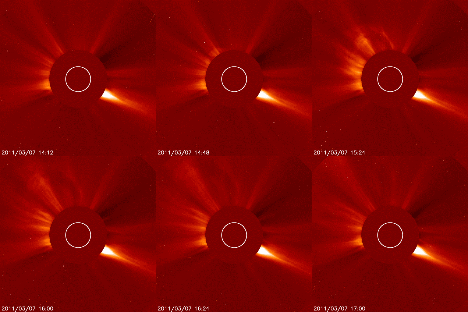
From Pat at survivepx....
Magnitude 6.2 - NEAR THE WEST COAST OF HONSHU, JAPAN
2011 March 11 18:59:15 UTC
Earthquake Details
- This event has been reviewed by a seismologist.
| Magnitude | 6.2 |
|---|---|
| Date-Time |
|
| Location | 37.037°N, 138.355°E |
| Depth | 1 km (~0.6 mile) |
| Region | NEAR THE WEST COAST OF HONSHU, JAPAN |
| Distances |
|
| Location Uncertainty | horizontal +/- 12.9 km (8.0 miles); depth +/- 0.2 km (0.1 miles) |
| Parameters | NST=409, Nph=415, Dmin=55.7 km, Rmss=1.16 sec, Gp= 29°, M-type=teleseismic moment magnitude (Mw), Version=9 |
| Source |
|
| Event ID | usc0001z2a |
| MAP | 6.1 | 2011/03/11 19:02:59 | 39.372 | 142.900 | 24.8 | NEAR THE EAST COAST OF HONSHU, JAPAN |
| MAP | 6.2 | 2011/03/11 18:59:15 | 37.037 | 138.355 | 1.0 | NEAR THE WEST COAST OF HONSHU, JAPAN |
| MAP | 5.1 | 2011/03/11 18:44:06 | 36.858 | 141.029 | 25.5 | NEAR THE EAST COAST OF HONSHU, JAPAN |
| MAP | 4.9 | 2011/03/11 18:43:14 | 40.139 | 143.061 | 89.7 | OFF THE EAST COAST OF HONSHU, JAPAN |
| MAP | 4.9 | 2011/03/11 18:39:34 | 37.916 | 143.055 | 1.8 | OFF THE EAST COAST OF HONSHU, JAPAN |
| MAP | 5.9 | 2011/03/11 18:17:06 | 36.218 | 141.685 | 25.4 | NEAR THE EAST COAST OF HONSHU, JAPAN |
| MAP | 5.7 | 2011/03/11 18:11:24 | 37.118 | 142.160 | 13.8 | OFF THE EAST COAST OF HONSHU, JAPAN |
| MAP | 4.7 | 2011/03/11 18:02:39 | 36.793 | 143.212 | 24.9 | OFF THE EAST COAST OF HONSHU, JAPAN |
| MAP | 5.0 | 2011/03/11 17:50:01 | 37.648 | 144.991 | 25.8 | OFF THE EAST COAST OF HONSHU, JAPAN |
| MAP | 5.4 | 2011/03/11 17:32:14 | 37.137 | 144.572 | 24.8 | OFF THE EAST COAST OF HONSHU, JAPAN |
| MAP | 5.1 | 2011/03/11 17:30:48 | 37.418 | 141.099 | 24.9 | NEAR THE EAST COAST OF HONSHU, JAPAN |
| MAP | 5.0 | 2011/03/11 17:23:57 | 36.015 | 141.888 | 24.9 | NEAR THE EAST COAST OF HONSHU, JAPAN |
| MAP | 5.5 | 2011/03/11 17:17:00 | 37.111 | 144.145 | 26.4 | OFF THE EAST COAST OF HONSHU, JAPAN |
| MAP | 4.8 | 2011/03/11 17:15:00 | 39.016 | 142.517 | 51.9 | NEAR THE EAST COAST OF HONSHU, JAPAN |
| MAP | 5.0 | 2011/03/11 17:12:41 | 37.564 | 144.069 | 25.1 | OFF THE EAST COAST OF HONSHU, JAPAN |
| MAP | 5.0 | 2011/03/11 16:55:53 | 37.779 | 143.171 | 25.1 | OFF THE EAST COAST OF HONSHU, JAPAN |
| MAP | 4.8 | 2011/03/11 16:54:53 | 12.304 | -87.514 | 64.3 | NEAR THE COAST OF NICARAGUA |
| MAP | 5.0 | 2011/03/11 16:34:22 | 39.376 | 143.405 | 40.8 | OFF THE EAST COAST OF HONSHU, JAPAN |
| MAP | 5.0 | 2011/03/11 16:20:52 | 36.157 | 141.877 | 25.3 | NEAR THE EAST COAST OF HONSHU, JAPAN |
| MAP | 5.5 | 2011/03/11 16:11:27 | 39.463 | 143.577 | 9.2 | OFF THE EAST COAST OF HONSHU, JAPAN |
| MAP | 5.3 | 2011/03/11 16:04:53 | 39.236 | 144.320 | 25.5 | OFF THE EAST COAST OF HONSHU, JAPAN |
| MAP | 5.0 | 2011/03/11 15:55:23 | 36.626 | 142.162 | 24.8 | OFF THE EAST COAST OF HONSHU, JAPAN |
| MAP | 5.0 | 2011/03/11 15:50:59 | 37.409 | 142.217 | 24.9 | OFF THE EAST COAST OF HONSHU, JAPAN |
| MAP | 5.0 | 2011/03/11 15:46:02 | 36.022 | 141.958 | 19.7 | NEAR THE EAST COAST OF HONSHU, JAPAN |
| MAP | 5.4 | 2011/03/11 15:42:05 | 36.066 | 141.515 | 15.8 | NEAR THE EAST COAST OF HONSHU, JAPAN |
| MAP | 4.9 | 2011/03/11 15:36:16 | 38.907 | 142.722 | 24.9 | NEAR THE EAST COAST OF HONSHU, JAPAN |
| MAP | 5.2 | 2011/03/11 15:32:34 | 37.216 | 142.233 | 25.0 | OFF THE EAST COAST OF HONSHU, JAPAN |
| MAP | 5.6 | 2011/03/11 15:19:38 | 36.233 | 141.856 | 25.0 | NEAR THE EAST COAST OF HONSHU, JAPAN |
| MAP | 6.2 | 2011/03/11 15:13:15 | 35.997 | 141.796 | 18.9 | NEAR THE EAST COAST OF HONSHU, JAPAN |
| MAP | 5.0 | 2011/03/11 15:01:39 | 39.082 | 142.383 | 26.0 | NEAR THE EAST COAST OF HONSHU, JAPAN |
| MAP | 5.8 | 2011/03/11 14:56:16 | 35.979 | 141.367 | 25.0 | NEAR THE EAST COAST OF HONSHU, JAPAN |
| MAP | 5.4 | 2011/03/11 14:54:04 | 35.919 | 141.819 | 24.9 | NEAR THE EAST COAST OF HONSHU, JAPAN |
| MAP | 5.1 | 2011/03/11 14:44:08 | 36.655 | 140.769 | 25.1 | NEAR THE EAST COAST OF HONSHU, JAPAN |
| MAP | 5.4 | 2011/03/11 14:26:31 | 37.431 | 142.254 | 13.2 | OFF THE EAST COAST OF HONSHU, JAPAN |
| MAP | 5.1 | 2011/03/11 14:20:20 | 37.947 | 143.183 | 25.2 | OFF THE EAST COAST OF HONSHU, JAPAN |
| MAP | 2.6 | 2011/03/11 14:18:29 | 35.271 | -92.339 | 4.0 | ARKANSAS |
| MAP | 5.2 | 2011/03/11 14:10:39 | 37.575 | 141.963 | 25.5 | NEAR THE EAST COAST OF HONSHU, JAPAN |
| MAP | 5.5 | 2011/03/11 14:00:38 | 36.151 | 140.845 | 30.8 | NEAR THE EAST COAST OF HONSHU, JAPAN |
| MAP | 4.9 | 2011/03/11 13:58:50 | 36.681 | 141.776 | 25.3 | NEAR THE EAST COAST OF HONSHU, JAPAN |
| MAP | 5.2 | 2011/03/11 13:55:28 | 38.039 | 142.831 | 24.9 | NEAR THE EAST COAST OF HONSHU, JAPAN |
| MAP | 5.3 | 2011/03/11 13:48:38 | 38.426 | 143.061 | 25.1 | OFF THE EAST COAST OF HONSHU, JAPAN |
| MAP | 5.6 | 2011/03/11 13:43:10 | 38.972 | 144.209 | 25.2 | OFF THE EAST COAST OF HONSHU, JAPAN |
| MAP | 4.9 | 2011/03/11 13:42:27 | 37.410 | 142.009 | 25.3 | OFF THE EAST COAST OF HONSHU, JAPAN |
| MAP | 5.6 | 2011/03/11 13:34:36 | 36.249 | 141.850 | 35.5 | NEAR THE EAST COAST OF HONSHU, JAPAN |
| MAP | 5.1 | 2011/03/11 13:31:55 | 39.152 | 142.837 | 25.0 | NEAR THE EAST COAST OF HONSHU, JAPAN |
| MAP | 2.5 | 2011/03/11 13:21:37 | 64.121 | -147.324 | 17.1 | CENTRAL ALASKA |
| MAP | 5.8 | 2011/03/11 13:16:50 | 36.304 | 141.730 | 30.1 | NEAR THE EAST COAST OF HONSHU, JAPAN |
| MAP | 5.1 | 2011/03/11 13:15:45 | 37.393 | 141.882 | 30.1 | NEAR THE EAST COAST OF HONSHU, JAPAN |
| MAP | 5.3 | 2011/03/11 13:02:43 | 36.755 | 141.885 | 30.2 | NEAR THE EAST COAST OF HONSHU, JAPAN |
| MAP | 5.3 | 2011/03/11 12:59:21 | 36.128 | 141.768 | 24.9 | NEAR THE EAST COAST OF HONSHU, JAPAN |
| MAP | 5.4 | 2011/03/11 12:54:52 | 38.502 | 142.120 | 36.7 | NEAR THE EAST COAST OF HONSHU, JAPAN |
| MAP | 5.6 | 2011/03/11 12:49:01 | 36.158 | 141.711 | 25.0 | NEAR THE EAST COAST OF HONSHU, JAPAN |
| MAP | 5.3 | 2011/03/11 12:34:22 | 36.912 | 143.736 | 39.0 | OFF THE EAST COAST OF HONSHU, JAPAN |
| MAP | 5.2 | 2011/03/11 12:33:19 | 38.374 | 142.590 | 29.7 | NEAR THE EAST COAST OF HONSHU, JAPAN |
| MAP | 5.2 | 2011/03/11 12:28:45 | 36.166 | 141.664 | 29.3 | NEAR THE EAST COAST OF HONSHU, JAPAN |
| MAP | 5.3 | 2011/03/11 12:24:37 | 36.525 | 141.707 | 27.8 | NEAR THE EAST COAST OF HONSHU, JAPAN |
| MAP | 3.3 | 2011/03/11 12:15:07 | 51.200 | -178.414 | 15.8 | ANDREANOF ISLANDS, ALEUTIAN IS., ALASKA |
| MAP | 5.9 | 2011/03/11 12:12:53 | 38.052 | 142.542 | 21.6 | NEAR THE EAST COAST OF HONSHU, JAPAN |
| MAP | 5.1 | 2011/03/11 12:04:16 | 36.351 | 142.700 | 38.4 | OFF THE EAST COAST OF HONSHU, JAPAN |
| MAP | 5.5 | 2011/03/11 11:56:16 | 36.356 | 141.504 | 39.4 | NEAR THE EAST COAST OF HONSHU, JAPAN |
| MAP | 5.1 | 2011/03/11 11:54:02 | 36.982 | 142.535 | 45.0 | OFF THE EAST COAST OF HONSHU, JAPAN |
| MAP | 5.8 | 2011/03/11 11:46:47 | 36.034 | 141.055 | 47.5 | NEAR THE EAST COAST OF HONSHU, JAPAN |
| MAP | 5.8 | 2011/03/11 11:44:28 | 36.709 | 142.231 | 31.0 | OFF THE EAST COAST OF HONSHU, JAPAN |
| MAP | 6.5 | 2011/03/11 11:36:39 | 39.276 | 142.521 | 11.6 | NEAR THE EAST COAST OF HONSHU, JAPAN |
| MAP | 5.7 | 2011/03/11 11:21:02 | 35.759 | 140.913 | 25.2 | NEAR THE EAST COAST OF HONSHU, JAPAN |
| MAP | 5.5 | 2011/03/11 11:16:51 | 36.614 | 141.894 | 36.6 | NEAR THE EAST COAST OF HONSHU, JAPAN |
| MAP | 5.5 | 2011/03/11 11:13:12 | 36.451 | 141.789 | 18.2 | NEAR THE EAST COAST OF HONSHU, JAPAN |
| MAP | 5.5 | 2011/03/11 11:10:58 | 35.534 | 141.856 | 27.7 | NEAR THE EAST COAST OF HONSHU, JAPAN |
| MAP | 5.6 | 2011/03/11 11:00:51 | 37.813 | 141.481 | 28.7 | NEAR THE EAST COAST OF HONSHU, JAPAN |
| MAP | 5.1 | 2011/03/11 10:58:06 | 39.060 | 142.213 | 30.3 | NEAR THE EAST COAST OF HONSHU, JAPAN |
| MAP | 3.2 | 2011/03/11 10:56:23 | 35.496 | -97.090 | 4.7 | OKLAHOMA |
| MAP | 5.0 | 2011/03/11 10:52:08 | 38.534 | 143.346 | 29.9 | OFF THE EAST COAST OF HONSHU, JAPAN |
| MAP | 5.5 | 2011/03/11 10:45:46 | 38.466 | 143.591 | 41.1 | OFF THE EAST COAST OF HONSHU, JAPAN |
| MAP | 5.3 | 2011/03/11 10:35:36 | 37.044 | 141.298 | 25.8 | NEAR THE EAST COAST OF HONSHU, JAPAN |
| MAP | 5.9 | 2011/03/11 10:28:44 | 39.447 | 143.531 | 29.3 | OFF THE EAST COAST OF HONSHU, JAPAN |
| MAP | 5.6 | 2011/03/11 10:20:27 | 36.966 | 142.289 | 21.7 | OFF THE EAST COAST OF HONSHU, JAPAN |
| MAP | 6.0 | 2011/03/11 10:10:35 | 39.248 | 142.779 | 28.9 | NEAR THE EAST COAST OF HONSHU, JAPAN |
| MAP | 5.2 | 2011/03/11 09:59:57 | 36.703 | 142.207 | 41.6 | OFF THE EAST COAST OF HONSHU, JAPAN |
| MAP | 5.5 | 2011/03/11 09:47:02 | 39.685 | 142.938 | 29.7 | NEAR THE EAST COAST OF HONSHU, JAPAN |
| MAP | 2.7 | 2011/03/11 09:45:07 | 19.295 | -154.944 | 10.8 | HAWAII REGION, HAWAII |
| MAP | 5.2 | 2011/03/11 09:42:22 | 39.438 | 142.749 | 30.2 | NEAR THE EAST COAST OF HONSHU, JAPAN |
| MAP | 5.4 | 2011/03/11 09:37:08 | 35.877 | 141.585 | 29.9 | NEAR THE EAST COAST OF HONSHU, JAPAN |
| MAP | 3.0 | 2011/03/11 09:33:58 | 19.382 | -155.015 | 7.6 | ISLAND OF HAWAII, HAWAII |
| MAP | 2.9 | 2011/03/11 09:24:53 | 19.351 | -154.999 | 8.7 | HAWAII REGION, HAWAII |
| MAP | 2.8 | 2011/03/11 09:14:36 | 19.329 | -154.970 | 11.0 | HAWAII REGION, HAWAII |
| MAP | 2.8 | 2011/03/11 09:10:26 | 19.355 | -155.000 | 5.4 | ISLAND OF HAWAII, HAWAII |
| MAP | 5.5 | 2011/03/11 09:09:15 | 37.717 | 143.267 | 36.2 | OFF THE EAST COAST OF HONSHU, JAPAN |
| MAP | 2.5 | 2011/03/11 09:07:01 | 19.347 | -154.989 | 0.1 | HAWAII REGION, HAWAII |
| MAP | 2.8 | 2011/03/11 09:05:23 | 19.373 | -155.001 | 8.5 | ISLAND OF HAWAII, HAWAII |
| MAP | 5.4 | 2011/03/11 09:04:10 | 37.299 | 142.655 | 30.5 | OFF THE EAST COAST OF HONSHU, JAPAN |
| MAP | 3.3 | 2011/03/11 09:03:38 | 19.349 | -154.950 | 31.4 | HAWAII REGION, HAWAII |
| MAP | 5.2 | 2011/03/11 09:00:20 | 37.056 | 141.966 | 20.0 | NEAR THE EAST COAST OF HONSHU, JAPAN |
| MAP | 4.6 | 2011/03/11 08:58:26 | 19.340 | -154.992 | 9.3 | HAWAII REGION, HAWAII |
| MAP | 5.4 | 2011/03/11 08:52:26 | 36.763 | 141.910 | 35.8 | NEAR THE EAST COAST OF HONSHU, JAPAN |
| MAP | 5.5 | 2011/03/11 08:46:48 | 37.421 | 142.453 | 37.3 | OFF THE EAST COAST OF HONSHU, JAPAN |
| MAP | 5.9 | 2011/03/11 08:40:56 | 37.465 | 141.122 | 38.6 | NEAR THE EAST COAST OF HONSHU, JAPAN |
| MAP | 6.1 | 2011/03/11 08:31:08 | 37.428 | 141.200 | 25.0 | NEAR THE EAST COAST OF HONSHU, JAPAN |
| MAP | 6.5 | 2011/03/11 08:19:24 | 36.200 | 142.000 | 19.9 | OFF THE EAST COAST OF HONSHU, JAPAN |
| MAP | 6.2 | 2011/03/11 08:15:41 | 37.034 | 144.612 | 27.8 | OFF THE EAST COAST OF HONSHU, JAPAN |
| MAP | 6.2 | 2011/03/11 08:12:05 | 36.606 | 141.557 | 19.8 | NEAR THE EAST COAST OF HONSHU, JAPAN |
| MAP | 5.5 | 2011/03/11 08:10:31 | 36.394 | 140.631 | 30.4 | NEAR THE EAST COAST OF HONSHU, JAPAN |
| MAP | 5.9 | 2011/03/11 08:01:59 | 37.071 | 142.734 | 22.6 | OFF THE EAST COAST OF HONSHU, JAPAN |
| MAP | 5.6 | 2011/03/11 07:56:16 | 37.130 | 142.305 | 34.0 | OFF THE EAST COAST OF HONSHU, JAPAN |
| MAP | 5.7 | 2011/03/11 07:54:45 | 37.742 | 141.565 | 45.3 | NEAR THE EAST COAST OF HONSHU, JAPAN |
| MAP | 5.8 | 2011/03/11 07:42:55 | 36.406 | 141.919 | 29.9 | NEAR THE EAST COAST OF HONSHU, JAPAN |
| MAP | 5.9 | 2011/03/11 07:38:27 | 39.250 | 142.783 | 29.1 | NEAR THE EAST COAST OF HONSHU, JAPAN |
| MAP | 4.4 | 2011/03/11 07:36:12 | 51.262 | -178.401 | 22.0 | ANDREANOF ISLANDS, ALEUTIAN IS., ALASKA |
| MAP | 6.1 | 2011/03/11 07:28:12 | 36.802 | 141.911 | 24.0 | NEAR THE EAST COAST OF HONSHU, JAPAN |
| MAP | 6.1 | 2011/03/11 07:25:33 | 37.916 | 144.621 | 15.0 | OFF THE EAST COAST OF HONSHU, JAPAN |
| MAP | 6.3 | 2011/03/11 07:14:59 | 36.648 | 141.811 | 25.0 | NEAR THE EAST COAST OF HONSHU, JAPAN |
| MAP | 5.9 | 2011/03/11 07:13:47 | 36.051 | 142.347 | 28.5 | OFF THE EAST COAST OF HONSHU, JAPAN |
| MAP | 5.8 | 2011/03/11 07:11:00 | 37.899 | 142.734 | 30.0 | OFF THE EAST COAST OF HONSHU, JAPAN |
| MAP | 6.3 | 2011/03/11 06:57:15 | 35.758 | 140.992 | 30.2 | NEAR THE EAST COAST OF HONSHU, JAPAN |
| MAP | 6.3 | 2011/03/11 06:48:47 | 37.993 | 142.764 | 22.3 | OFF THE EAST COAST OF HONSHU, JAPAN |
| MAP | 7.1 | 2011/03/11 06:25:51 | 38.106 | 144.553 | 19.7 | OFF THE EAST COAST OF HONSHU, JAPAN |
| MAP | 3.2 | 2011/03/11 06:18:04 | 19.350 | -154.991 | 9.5 | HAWAII REGION, HAWAII |
| MAP | 6.8 | 2011/03/11 06:15:40 | 36.186 | 141.192 | 35.0 | NEAR THE EAST COAST OF HONSHU, JAPAN |
| MAP | 6.4 | 2011/03/11 06:07:22 | 36.401 | 141.862 | 35.4 | NEAR THE EAST COAST OF HONSHU, JAPAN |
| MAP | 6.4 | 2011/03/11 06:06:11 | 39.025 | 142.316 | 25.1 | NEAR THE EAST COAST OF HONSHU, JAPAN |
| MAP | 8.9 | 2011/03/11 05:46:24 | 38.322 | 142.369 | 24.4 | NEAR THE EAST COAST OF HONSHU, JAPAN |
| MAP | 3.4 | 2011/03/11 04:51:25 | 35.351 | -118.561 | 5.4 | CENTRAL CALIFORNIA |
| MAP | 4.8 | 2011/03/11 04:28:21 | 47.849 | 154.247 | 39.6 | KURIL ISLANDS |
| MAP | 4.5 | 2011/03/11 04:05:41 | 19.586 | -109.136 | 10.2 | REVILLA GIGEDO ISLANDS REGION |
| MAP | 2.6 | 2011/03/11 02:55:42 | 19.363 | -154.994 | 9.3 | HAWAII REGION, HAWAII |
| MAP | 2.9 | 2011/03/11 02:52:08 | 19.348 | -154.981 | 10.7 | HAWAII REGION, HAWAII |
| MAP | 2.5 | 2011/03/11 02:32:09 | 19.348 | -154.985 | 11.1 | HAWAII REGION, HAWAII |
| MAP | 2.8 | 2011/03/11 01:02:00 | 19.345 | -154.983 | 10.2 | HAWAII REGION, HAWAII |
| MAP | 2.5 | 2011/03/11 00:53:59 | 19.352 | -154.989 | 9.0 | HAWAII REGION, HAWAII |
| MAP | 4.0 | 2011/03/11 00:25:29 | 18.897 | -68.855 | 166.1 | DOMINICAN REPUBLIC |
| MAP | 5.3 | 2011/03/11 00:14:51 | -54.369 | -116.808 | 10.0 | SOUTHERN EAST PACIFIC RISE |